MyTopo
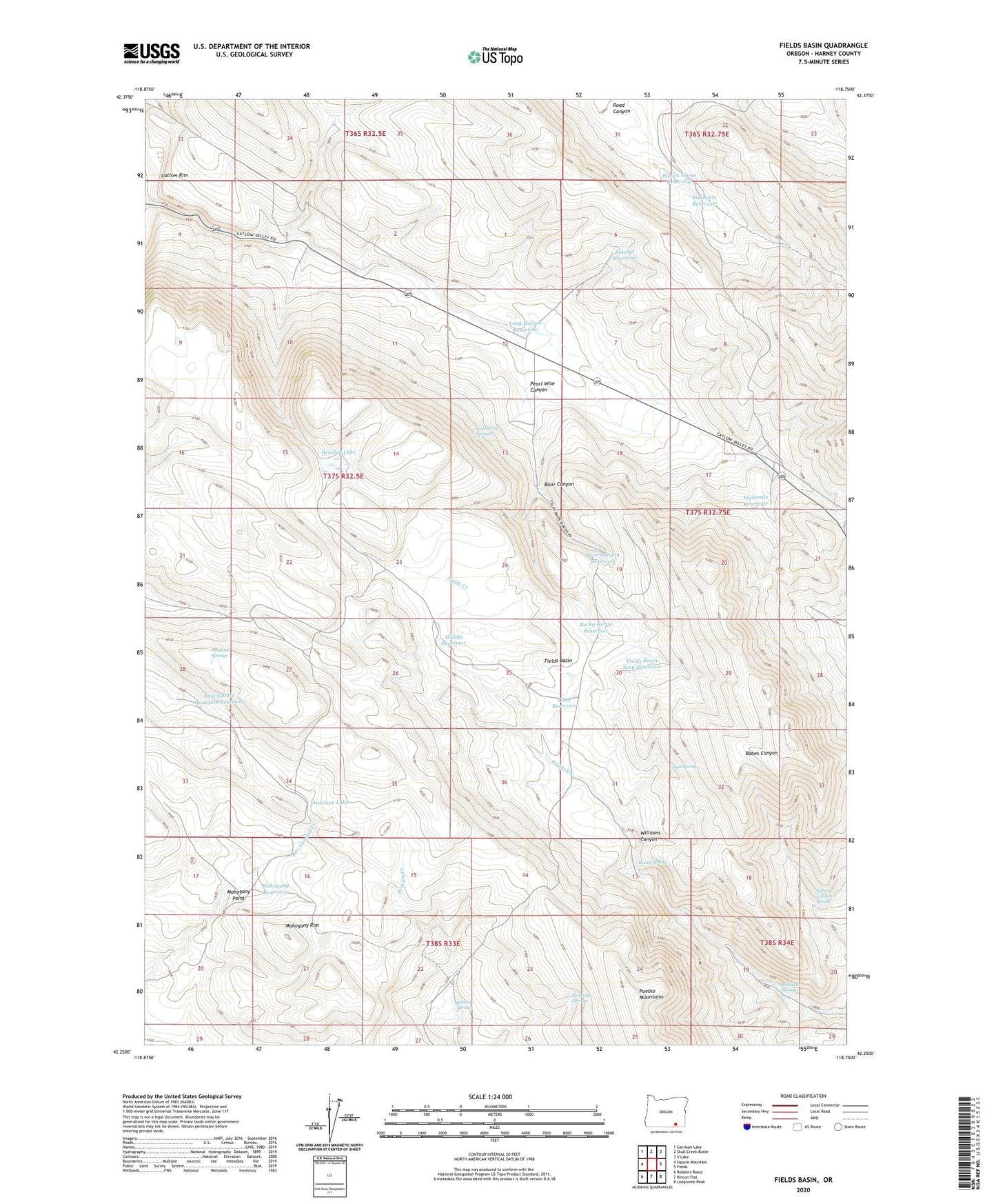
Fields Basin Oregon US Topo Map
Couldn't load pickup availability
2023 topographic map quadrangle Fields Basin in the state of Oregon. Scale: 1:24000. Based on the newly updated USGS 7.5' US Topo map series, this map is in the following counties: Harney. The map contains contour data, water features, and other items you are used to seeing on USGS maps, but also has updated roads and other features. This is the next generation of topographic maps. Printed on high-quality waterproof paper with UV fade-resistant inks.
Quads adjacent to this one:
West: Square Mountain
Northwest: Garrison Lake
North: Skull Creek Butte
Northeast: V Lake
East: Fields
Southeast: Ladycomb Peak
South: Rincon Flat
Southwest: Robbers Roost
This map covers the same area as the classic USGS quad with code o42118c7.
Contains the following named places: Antelope Lake, Antelope Springs, Babes Canyon Spring, Big Basin Reservoir, Blair Canyon, Blair Canyon Reservoir, Bradley Lake, Cone Reservoir, East Square Mountain Reservoir, Eightmile Reservoir, Eleven Horse Reservoir, Fields Basin, Fields Basin Seep Reservoir, Long Hollow Reservoir, Long Hollow Summit, Mahogany Point, Mahogany Reservoir, Mahogany Rim, McDade Springs, Middle Reservoir, Mud Spring, Pearl Wise Canyon, Pearl Wise Springs, Rincon Lake, Rincon Springs, Rocky Gorge Reservoir, Rocky Spring, Sidehill Reservoir, The Beef Trail, Williams Springs