MyTopo
Flagtail Mountain Oregon US Topo Map
Couldn't load pickup availability
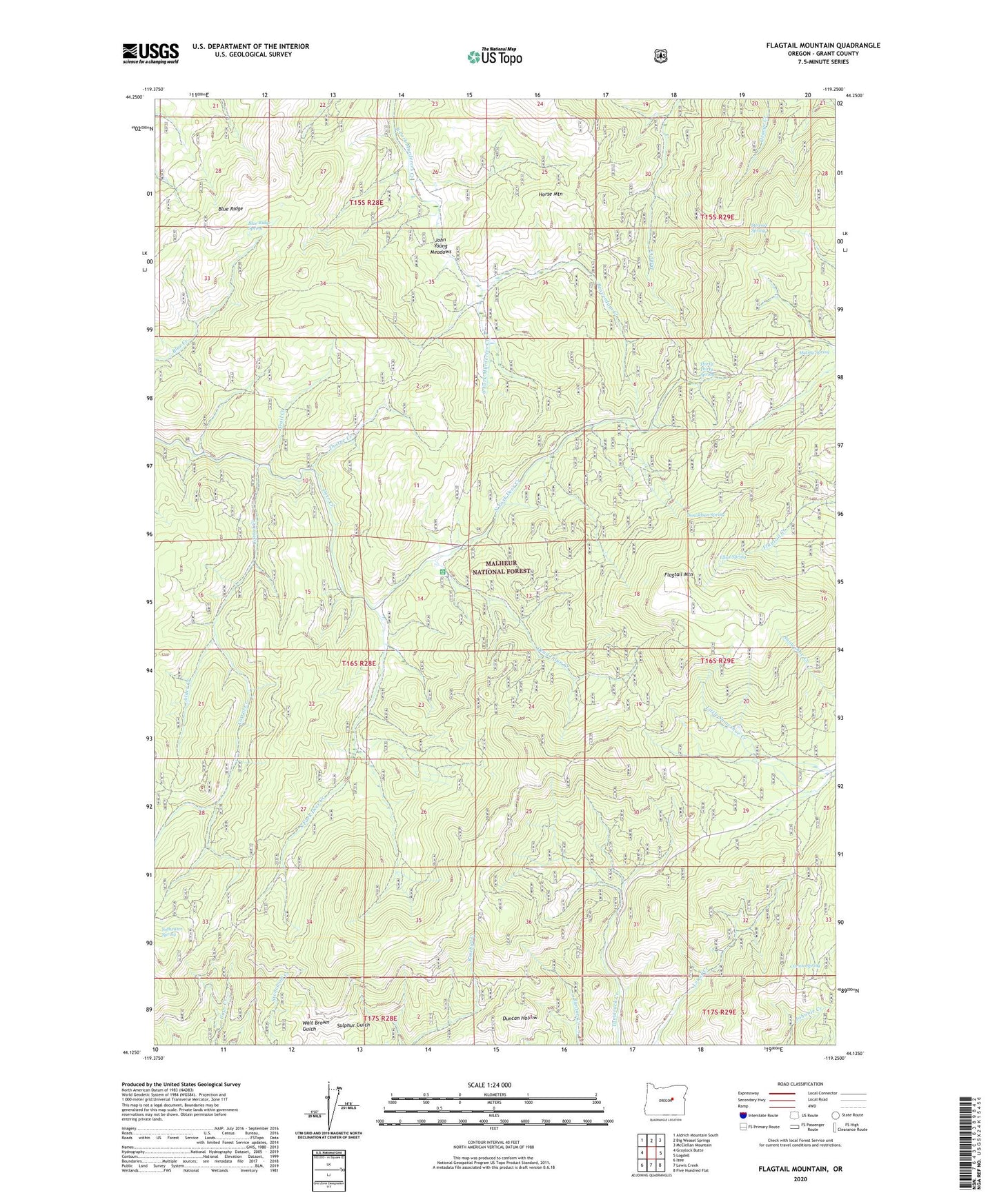
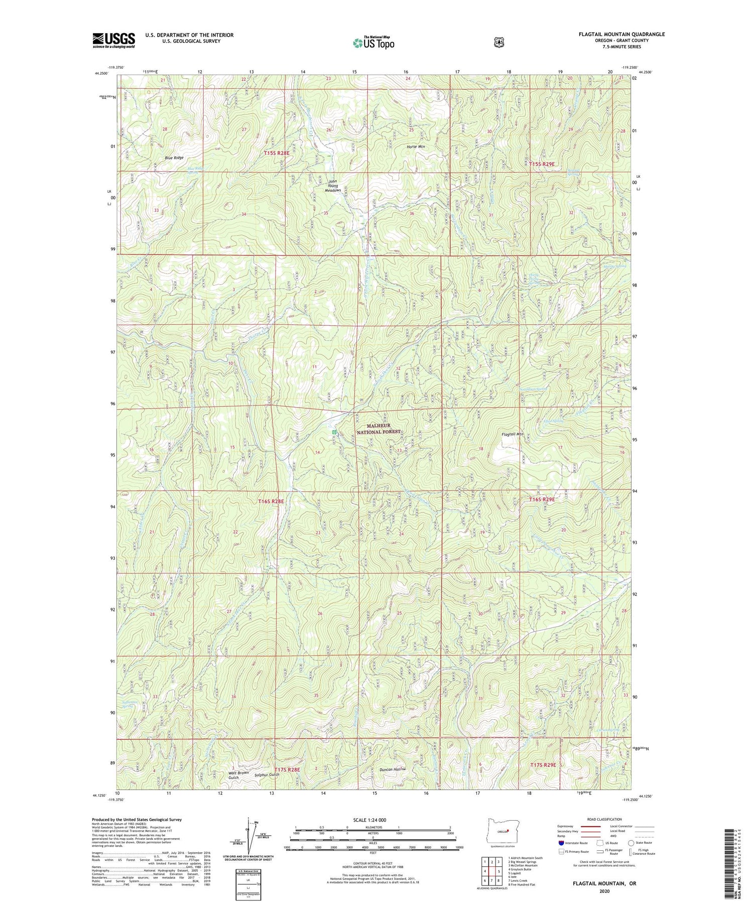
2020 topographic map quadrangle Flagtail Mountain in the state of Oregon. Scale: 1:24000. Based on the newly updated USGS 7.5' US Topo map series, this map is in the following counties: Grant. The map contains contour data, water features, and other items you are used to seeing on USGS maps, but also has updated roads and other features. This is the next generation of topographic maps. Printed on high-quality waterproof paper with UV fade-resistant inks.
Quads adjacent to this one:
West: Graylock Butte
Northwest: Aldrich Mountain South
North: Big Weasel Springs
Northeast: McClellan Mountain
East: Logdell
Southeast: Five Hundred Flat
South: Lewis Creek
Southwest: Izee
Contains the following named places: Alder Creek, Beaverdam Creek, Blue Ridge, Blue Ridge Spring, Carson Spring, Cliffs Camp, Corral Creek, Dead Injun Creek, Deer Creek Guard Station, Donaldson Spring, Elliot Spring, Flagtail Mountain, Flagtail Mountain Fire Lookout, Horse Mountain, John Young Meadows, Mutiny Spring, North Fork Deer Creek, Roba Brothers Mine, Roba Westfall Mine, Softwater Spring, South Fork Deer Creek, Stewart Spring, Thirty-Thirty Spring, Thorpe Creek, Trail Creek, York and Rannels Mine