MyTopo
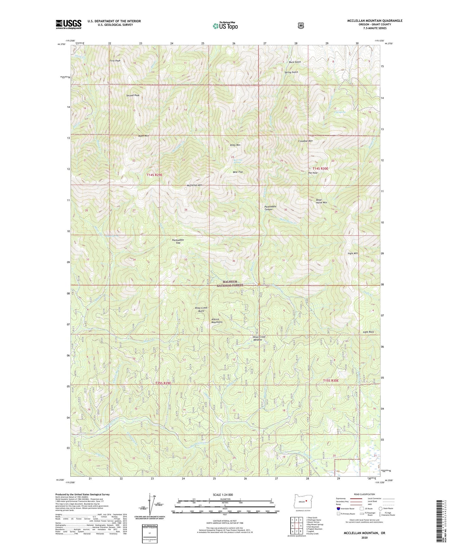
McClellan Mountain Oregon US Topo Map
Couldn't load pickup availability
Also explore the McClellan Mountain Forest Service Topo of this same quad for updated USFS data
2023 topographic map quadrangle McClellan Mountain in the state of Oregon. Scale: 1:24000. Based on the newly updated USGS 7.5' US Topo map series, this map is in the following counties: Grant. The map contains contour data, water features, and other items you are used to seeing on USGS maps, but also has updated roads and other features. This is the next generation of topographic maps. Printed on high-quality waterproof paper with UV fade-resistant inks.
Quads adjacent to this one:
West: Big Weasel Springs
Northwest: Shop Gulch
North: Wolfinger Butte
Northeast: Mount Vernon
East: Fall Mountain
Southeast: Scotty Creek
South: Logdell
Southwest: Flagtail Mountain
This map covers the same area as the classic USGS quad with code o44119c2.
Contains the following named places: Aldrich Mountains, Alkali Creek, Basin Creek, Bear Flat, Bear Flat Springs, Buck Gulch, Charlie Mack Creek, Cinnabar Mine, Cinnabar Mountain, Cold Spring, Dead Horse Creek, Dead Horse Mountain, First Peak, Grapefruit Creek, High Trail, Hoppy Spring, Ingle Mountain, Ingle Rock, Lime Creek, McClellan Mountain, Miner Creek, Moon Mountain, Packsaddle Canyon, Packsaddle Gap, Rail Creek, Riley Creek Butte, Riley Creek Meadow, Riley Mountain, Second Peak, Spring Gulch, Sugar Creek, The Hole, Third Creek, Umatilla Creek, White Creek