
MyTopo
Flat Mountain Oregon US Topo Map
Couldn't load pickup availability
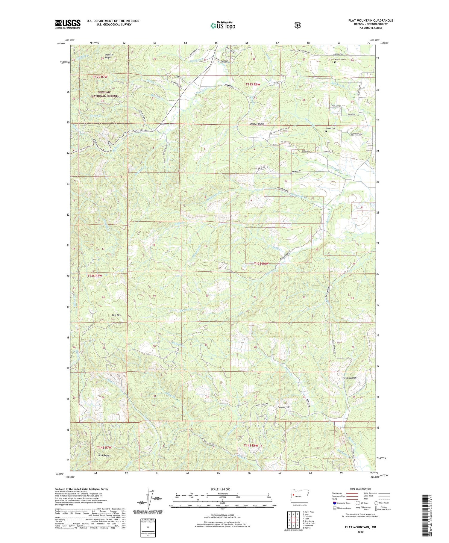
2020 topographic map quadrangle Flat Mountain in the state of Oregon. Scale: 1:24000. Based on the newly updated USGS 7.5' US Topo map series, this map is in the following counties: Benton. The map contains contour data, water features, and other items you are used to seeing on USGS maps, but also has updated roads and other features. This is the next generation of topographic maps. Printed on high-quality waterproof paper with UV fade-resistant inks.
Quads adjacent to this one:
West: Alsea
Northwest: Marys Peak
North: Wren
Northeast: Corvallis
East: Greenberry
Southeast: Monroe
South: Glenbrook
Southwest: Prairie Peak
Contains the following named places: Beaver Creek Seed Orchard, Benton County, Buck Peak, Bunker Hill, Cedar Creek, Cheyenne Creek, Decker Ridge, Dinner Creek, Duffy Creek, Emerick Cemetery, Ervin Creek, Flat Mountain, Franklin Ridge, Gleason Creek, Hells Canyon, Henderson Creek, Hyde Creek, Kiser Creek, Mercer Creek, Moss Creek, Powell Cemetery, Powell Creek, Rickard Creek, Ridenour Creek, Schreiber Lodge Boy Scout Camp, South Creek, Spencer Creek, Wells Creek, Westwood Creek


