MyTopo
Monroe Oregon US Topo Map
Couldn't load pickup availability
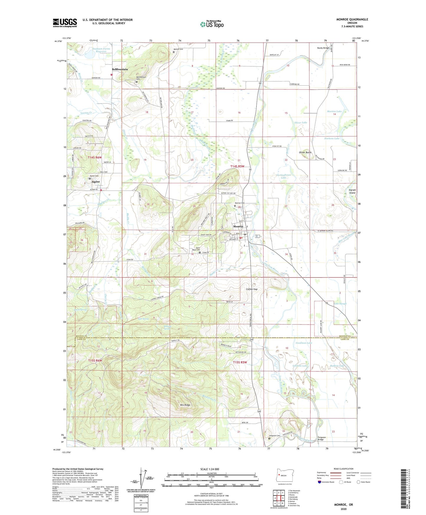
2023 topographic map quadrangle Monroe in the state of Oregon. Scale: 1:24000. Based on the newly updated USGS 7.5' US Topo map series, this map is in the following counties: Benton, Lane. The map contains contour data, water features, and other items you are used to seeing on USGS maps, but also has updated roads and other features. This is the next generation of topographic maps. Printed on high-quality waterproof paper with UV fade-resistant inks.
Quads adjacent to this one:
West: Glenbrook
Northwest: Flat Mountain
North: Greenberry
Northeast: Peoria
East: Harrisburg
Southeast: Junction City
South: Cheshire
Southwest: Horton
This map covers the same area as the classic USGS quad with code o44123c3.
Contains the following named places: Alpine, Alpine Cemetery, Alpine Census Designated Place, Alpine County Service District Sewage Facility, Alpine Junction, Alpine Post Office, Bailey Junction, Belknap Creek, Belknap Spring, Bellfountain, Bellfountain Cemetery, Bellfountain Census Designated Place, Bellfountain Junction, Bellfountain Post Office, Bundy Bridge, Burnett, Cherry Creek, City of Monroe, Coffee Gap, Eber Creek, Ferguson, Ferguson Bridge, Ferguson Cemetery, Ferguson Creek, Forks of Marys River Post Office, Garlinghouse Lake, Goodman Lake, Graham Lake, Hammer Creek, Harkens Lake, Hawley Creek, Herman Nusbaum Dam, Hewitt Spring, Hulbert Lake, Irish Bend School, Kinsey Reservoir, Kyle Creek, Kyle Spring, Lake Slough, Larsen Creek, Martins Lake, Miller Creek, Monroe, Monroe Cemetery, Monroe Church of Christ, Monroe City Hall, Monroe Grade School, Monroe High School, Monroe Municipal Court, Monroe Post Office, Monroe Public Library, Monroe Rural Fire Protection District Station 1, Monroe Rural Fire Protection District Station 2, Monroe Rural Fire Protection District Station 3, Monroe Sewage Treatment Plant, Nichols Creek, Nusbaum Farms Reservoir, Oliver Butte, Oliver Creek, Oliver Lake, Reese Creek, Reeves Cemetery, Saint Rose Cemetery, Shafer Creek, South Benton Communities Historical Association Museum, South Fork Ferguson Creek, Starrs Point, Starrs Point Post Office, United Methodist Church, Win Ridge, ZIP Code: 97456