MyTopo
Foley Peak Oregon US Topo Map
Couldn't load pickup availability
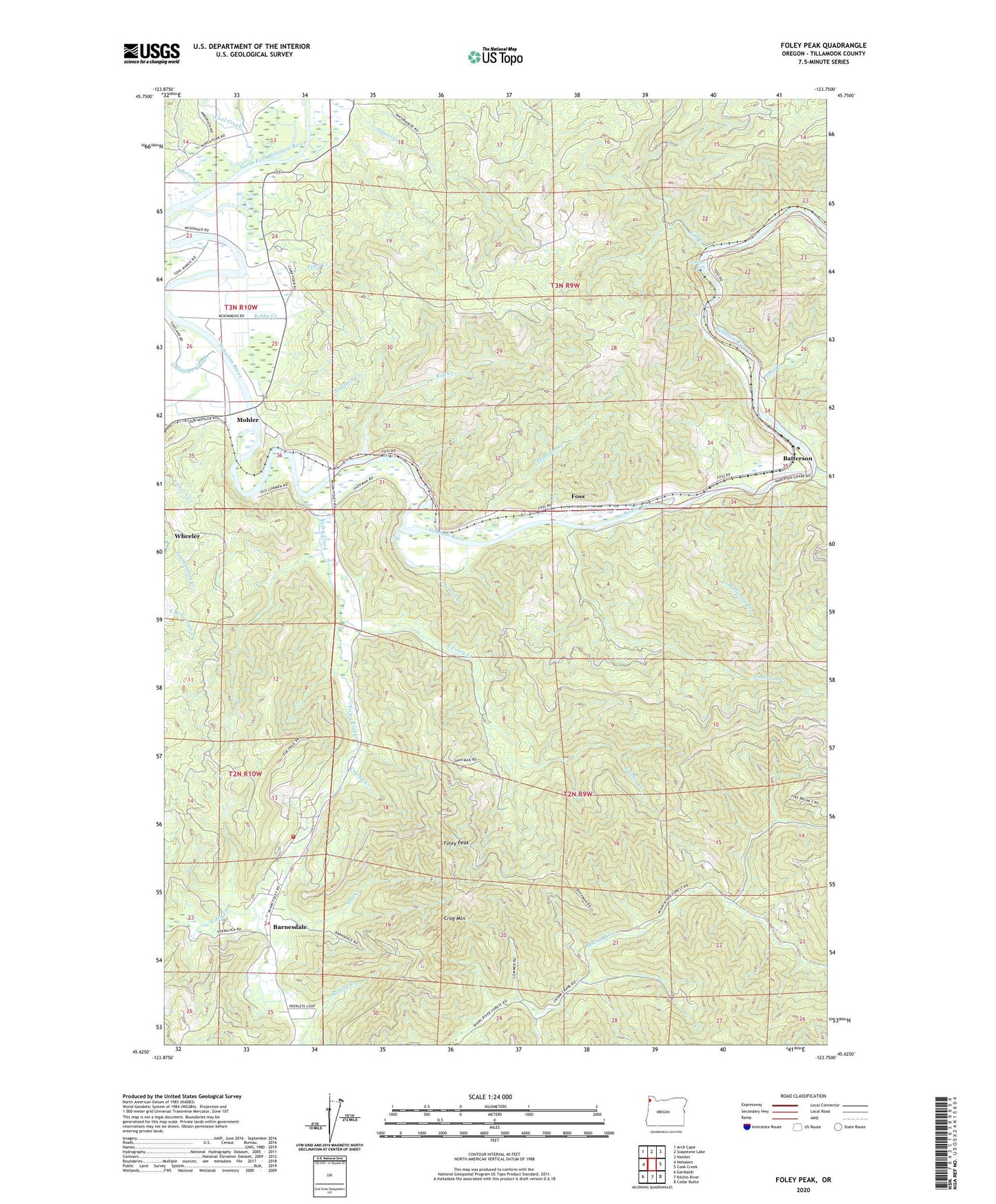
2020 topographic map quadrangle Foley Peak in the state of Oregon. Scale: 1:24000. Based on the newly updated USGS 7.5' US Topo map series, this map is in the following counties: Tillamook. The map contains contour data, water features, and other items you are used to seeing on USGS maps, but also has updated roads and other features. This is the next generation of topographic maps. Printed on high-quality waterproof paper with UV fade-resistant inks.
Quads adjacent to this one:
West: Nehalem
Northwest: Arch Cape
North: Soapstone Lake
Northeast: Hamlet
East: Cook Creek
Southeast: Cedar Butte
South: Kilchis River
Southwest: Garibaldi
Contains the following named places: Adair, Anderson Creek, Anglersvale, Anglersvale Post Office, Asay Dairy, Badger, Balm Post Office, Barnesdale, Barnesdale Census Designated Place, Barnesdale Post Office, Batterson, Batterson Creek, Blybach Post Office, Camp Nehalem, Coal Creek, Cook Creek, Crag Mountain, Crystal Creek, Dry Creek, East Foley Creek, Fall Creek, Foley, Foley Creek, Foley Peak, Foley Post Office, Foss, Foss Post Office, Gallagher Slough, Garibaldi Rural Fire District, Gravel Creek, Kebbe Creek, Knudson, Lost Creek, Lynbrook, McPherson Creek, Mohler, Mohler Post Office, Mohler Sand and Gravel Boat Launch, Nehalem Falls, Nehalem Falls Campground, Nehalem Fish Hatchery, Pearl Creek, Peterson Creek, Roy Creek, Roy Creek County Park Boat Launch, Roy Creek Park, School Creek, Stonehill, Upper Nehalem, Zaddach Creek, ZIP Code: 97131