
MyTopo
Fort Rock Oregon US Topo Map
Couldn't load pickup availability
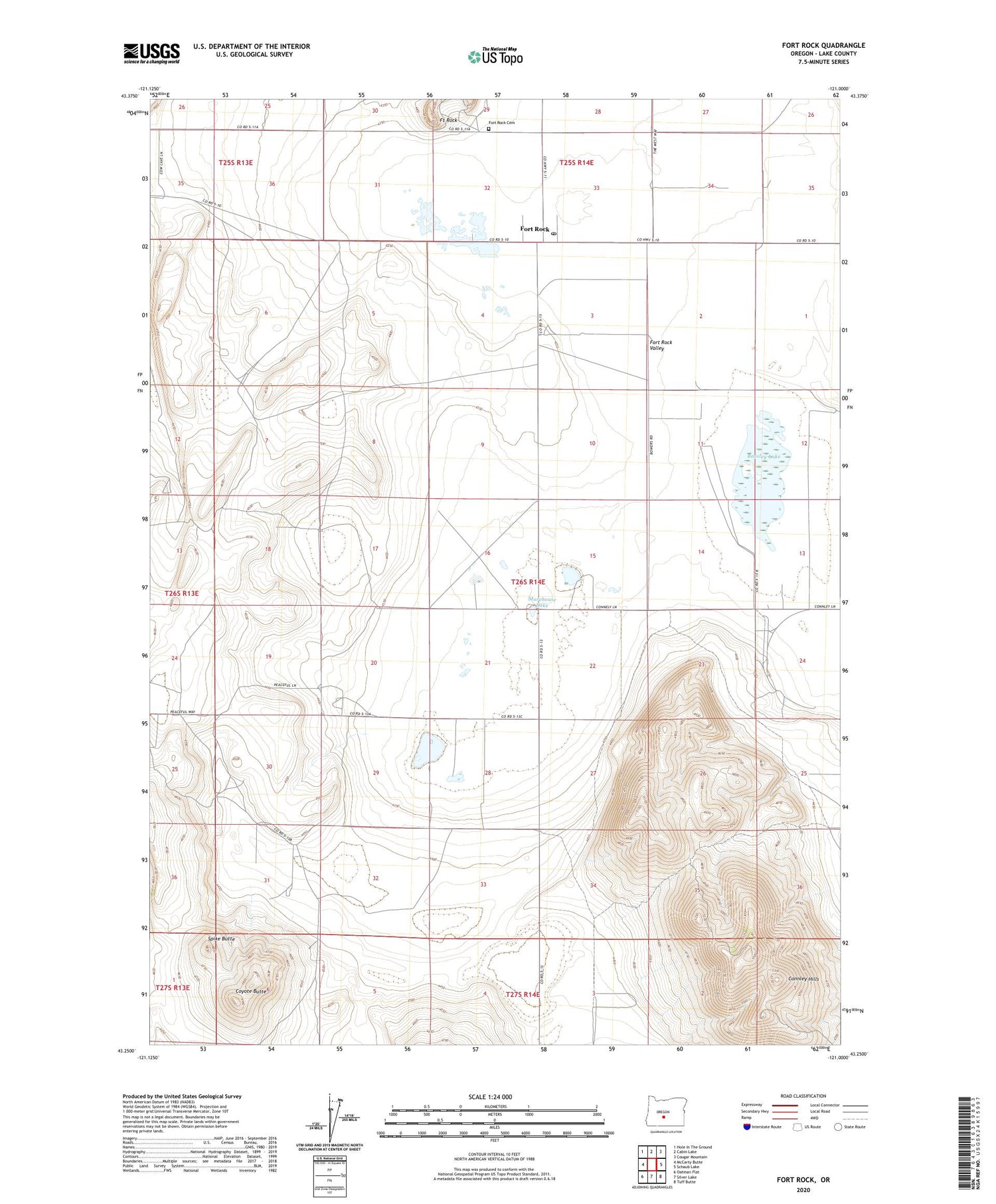
2020 topographic map quadrangle Fort Rock in the state of Oregon. Scale: 1:24000. Based on the newly updated USGS 7.5' US Topo map series, this map is in the following counties: Lake. The map contains contour data, water features, and other items you are used to seeing on USGS maps, but also has updated roads and other features. This is the next generation of topographic maps. Printed on high-quality waterproof paper with UV fade-resistant inks.
Quads adjacent to this one:
West: McCarty Butte
Northwest: Hole In The Ground
North: Cabin Lake
Northeast: Cougar Mountain
East: Schaub Lake
Southeast: Tuff Butte
South: Silver Lake
Southwest: Oatman Flat
Contains the following named places: Andrews Ranch, Beasley Lake, Community Seeding Well, Connley Hills, Coyote Butte, Fort Rock, Fort Rock Cemetery, Fort Rock Elementary School, Fort Rock Post Office, Fort Rock State Park, Fort Rock Valley Historical Homestead Museum, Gauldin Well, Gubser Well, Mattis Ranch, McGee Ranch, McGee Sawmill, Morehouse Lake, Morehouse Lake Reservoir, South Beeler Well, Spike Butte, Sprague Well, Thomas Well, Three-Mile Corner


