MyTopo
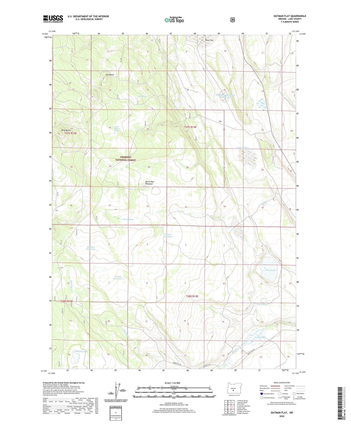
Oatman Flat Oregon US Topo Map
Couldn't load pickup availability
Also explore the Oatman Flat Forest Service Topo of this same quad for updated USFS data
2024 topographic map quadrangle Oatman Flat in the state of Oregon. Scale: 1:24000. Based on the newly updated USGS 7.5' US Topo map series, this map is in the following counties: Lake. The map contains contour data, water features, and other items you are used to seeing on USGS maps, but also has updated roads and other features. This is the next generation of topographic maps. Printed on high-quality waterproof paper with UV fade-resistant inks.
Quads adjacent to this one:
West: Antelope Mountain
Northwest: Wickiup Spring
North: McCarty Butte
Northeast: Fort Rock
East: Silver Lake
Southeast: Hager Mountain
South: Bridge Creek Draw
Southwest: Rodman Rock
This map covers the same area as the classic USGS quad with code o43121b2.
Contains the following named places: Baskin Spring, Deadmond Place, Devils Ball Diamond, Freeman Dry Camp, Halfway Lake, Lily Lake, Logger Waterhole, Meadow Waterhole, North Willow Spring, Oat Butte, Oatman Flat, R Emery Ranch, Ross Spring, Round Reservoir, Sears Flat, Shumacher Reservoir Number Five, Stratton Place, T Emery Ranch, Ward Lake, Williams Mill, Wing Butte, Wing Butte Cabin