MyTopo
Freezeout Ridge Oregon US Topo Map
Couldn't load pickup availability
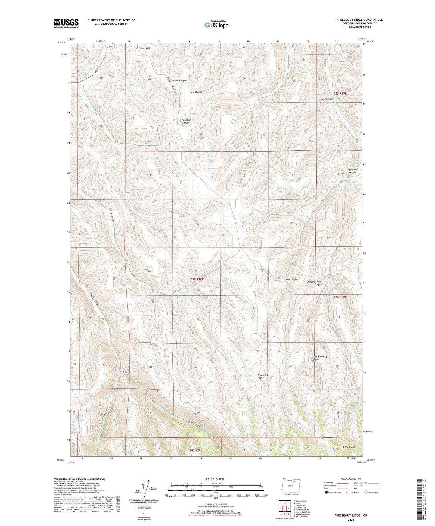
2024 topographic map quadrangle Freezeout Ridge in the state of Oregon. Scale: 1:24000. Based on the newly updated USGS 7.5' US Topo map series, this map is in the following counties: Morrow. The map contains contour data, water features, and other items you are used to seeing on USGS maps, but also has updated roads and other features. This is the next generation of topographic maps. Printed on high-quality waterproof paper with UV fade-resistant inks.
Quads adjacent to this one:
West: Skinners Fork
Northwest: Gleason Butte
North: Lena
Northeast: Franklin Hill
East: Hoodlum Canyon
Southeast: Matlock Prairie
South: Arbuckle Mountain
Southwest: Summerfield Ridge
This map covers the same area as the classic USGS quad with code o45119c3.
Contains the following named places: Big Sourdough Canyon, Heppner City Well, Howard Canyon, Little Sourdough Canyon, North Fork Willow Creek, Sawmill Canyon, Trail Canyon