MyTopo
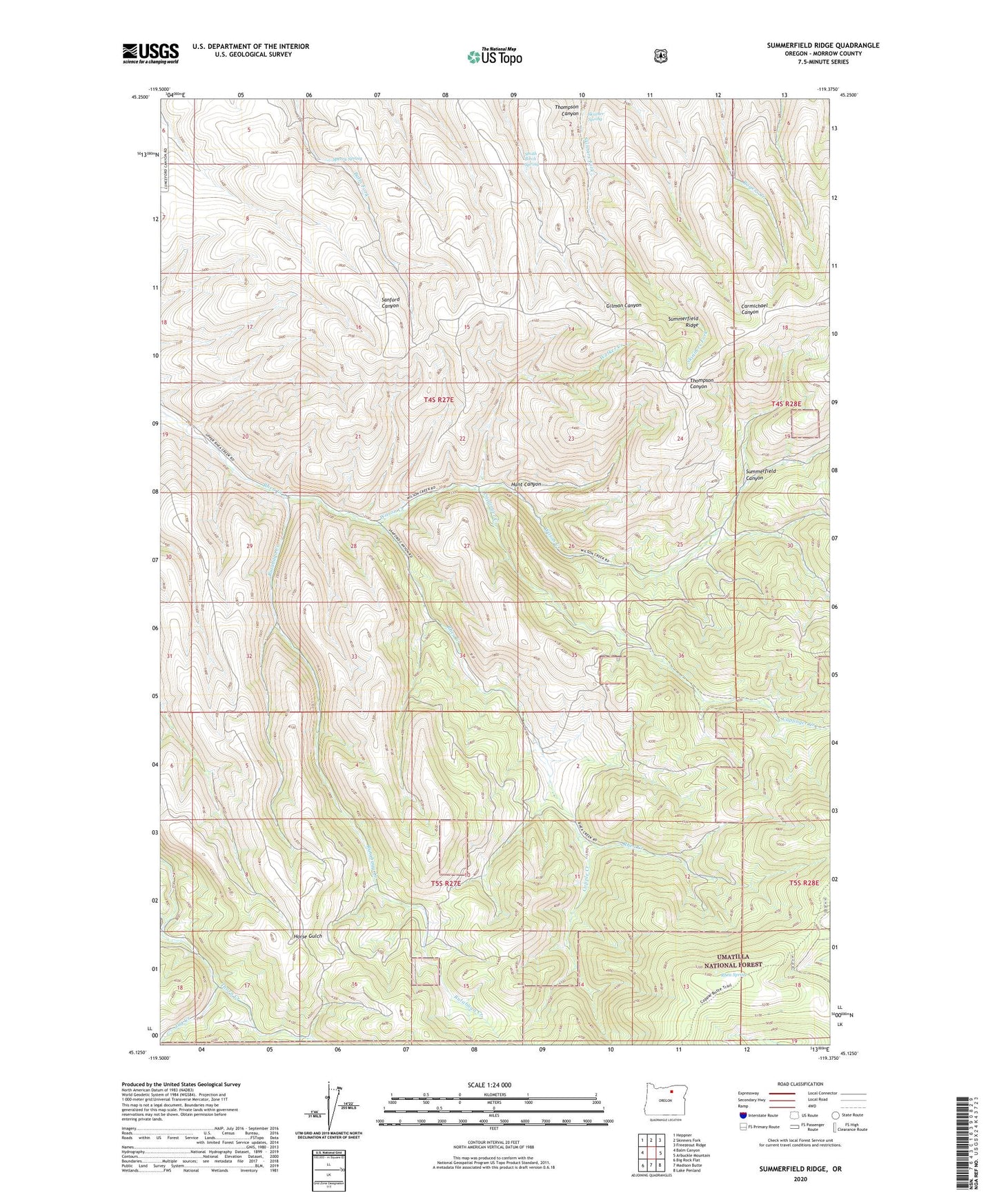
Summerfield Ridge Oregon US Topo Map
Couldn't load pickup availability
Also explore the Summerfield Ridge Forest Service Topo of this same quad for updated USFS data
2024 topographic map quadrangle Summerfield Ridge in the state of Oregon. Scale: 1:24000. Based on the newly updated USGS 7.5' US Topo map series, this map is in the following counties: Morrow. The map contains contour data, water features, and other items you are used to seeing on USGS maps, but also has updated roads and other features. This is the next generation of topographic maps. Printed on high-quality waterproof paper with UV fade-resistant inks.
Quads adjacent to this one:
West: Balm Canyon
Northwest: Heppner
North: Skinners Fork
Northeast: Freezeout Ridge
East: Arbuckle Mountain
Southeast: Lake Penland
South: Madison Butte
Southwest: Big Rock Flat
This map covers the same area as the classic USGS quad with code o45119b4.
Contains the following named places: Balm Fork School, Caplinger Creek, Copple Creek, Hunt Canyon, Jug Creek, Reids Mill, Rhea Spring, Rutabaga Creek, Skinner Spring, Smith Birch Spring, Sperry Spring, Summerfield Canyon, Walker Creek, Wilson Creek