MyTopo
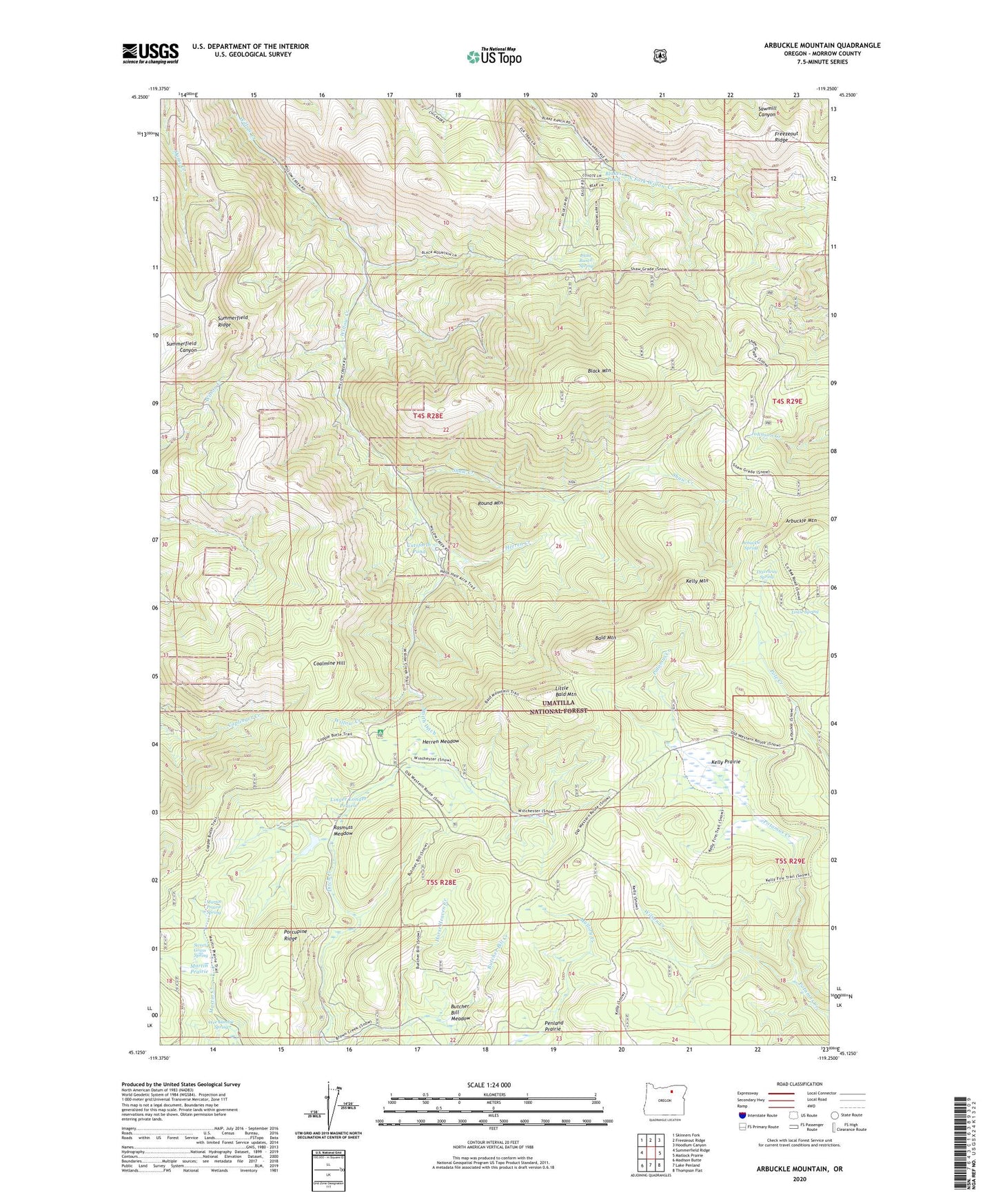
Arbuckle Mountain Oregon US Topo Map
Couldn't load pickup availability
Also explore the Arbuckle Mountain Forest Service Topo of this same quad for updated USFS data
2024 topographic map quadrangle Arbuckle Mountain in the state of Oregon. Scale: 1:24000. Based on the newly updated USGS 7.5' US Topo map series, this map is in the following counties: Morrow. The map contains contour data, water features, and other items you are used to seeing on USGS maps, but also has updated roads and other features. This is the next generation of topographic maps. Printed on high-quality waterproof paper with UV fade-resistant inks.
Quads adjacent to this one:
West: Summerfield Ridge
Northwest: Skinners Fork
North: Freezeout Ridge
Northeast: Hoodlum Canyon
East: Matlock Prairie
Southeast: Thompson Flat
South: Lake Penland
Southwest: Madison Butte
This map covers the same area as the classic USGS quad with code o45119b3.
Contains the following named places: Arbuckle Corral, Arbuckle Mountain, Arbuckle Spring, Bald Mountain, Black Mountain, Blake Ranch Spring, Blakes Pond, Butcher Bill Meadow, Coalmine Hill, Coalmine Hill Recreation Site, Cutsforth County Park, Cutsforth Pond, Driveway Spring, Freezeout Ridge, Herren Creek, Herren Meadow, Horse Heaven Creek, Kelly Mountain, Kelly Prairie, Linger Longer Prairie, Little Bald Mountain, Louse Spring, Martin Prairie, Martin Prairie Spring, Penland Prairie, Porcupine Ridge, Rasmuss Meadow, Round Mountain, Shaw Creek, Smith Ditch, Summerfield Ridge, Sweet Grass Spring, Wee Lambie Spring, Wilson Creek, Yokum Cabin