MyTopo
Gearhart Mountain Oregon US Topo Map
Couldn't load pickup availability
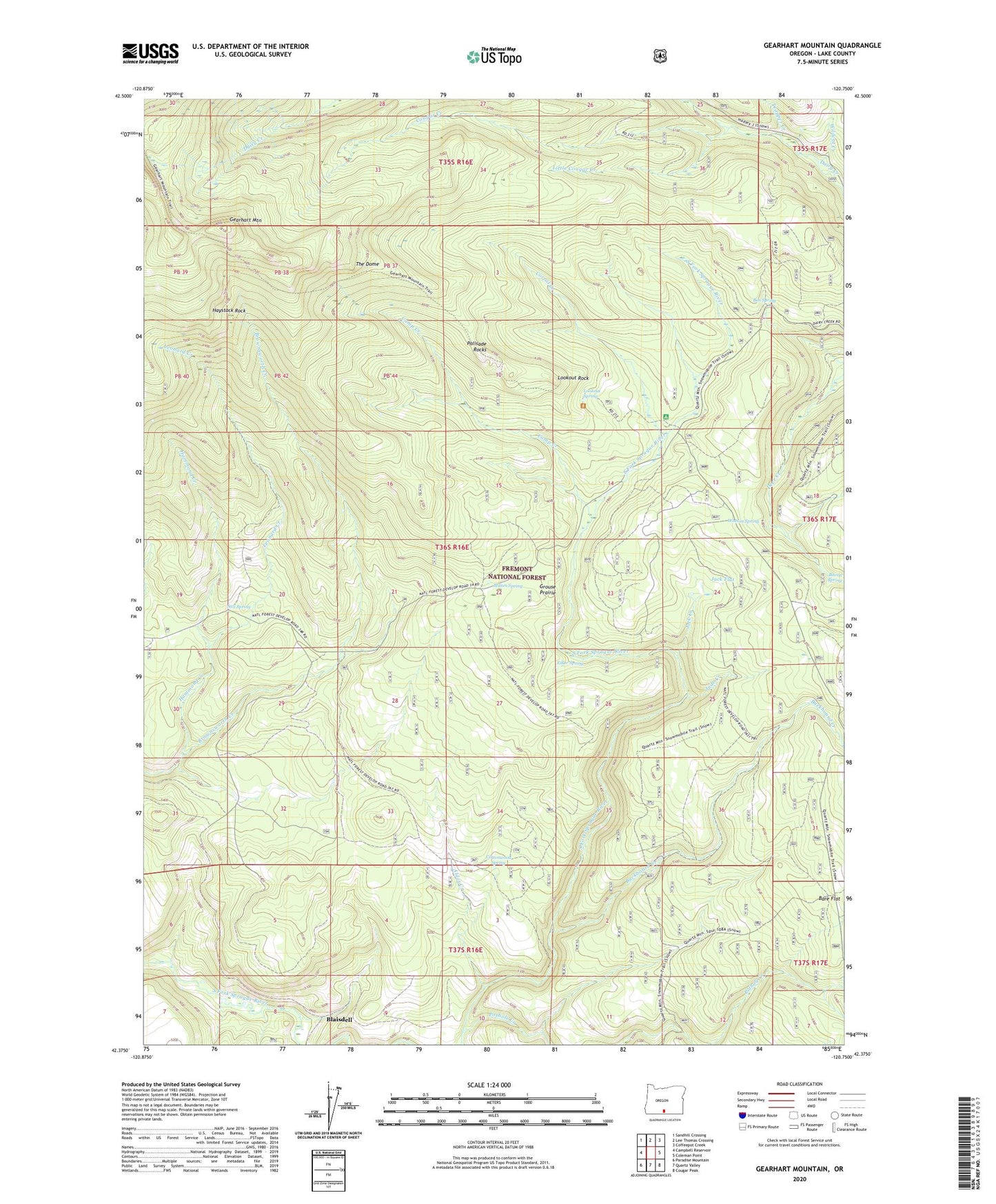
2020 topographic map quadrangle Gearhart Mountain in the state of Oregon. Scale: 1:24000. Based on the newly updated USGS 7.5' US Topo map series, this map is in the following counties: Lake. The map contains contour data, water features, and other items you are used to seeing on USGS maps, but also has updated roads and other features. This is the next generation of topographic maps. Printed on high-quality waterproof paper with UV fade-resistant inks.
Quads adjacent to this one:
West: Campbell Reservoir
Northwest: Sandhill Crossing
North: Lee Thomas Crossing
Northeast: Coffeepot Creek
East: Coleman Point
Southeast: Cougar Peak
South: Quartz Valley
Southwest: Paradise Mountain
Contains the following named places: Alder Creek, Bare Flat, Blaisdell, Box Spring, Buckboard Creek, Camp Creek, Cookes Camp, Corral Creek, Corral Creek Recreation Site, Cottonwood Spring, Cougar Creek, Coykendall Cabin, Edler Spring, Finley Corrals, Grouse Prairie, Hammond Creek, Haystack Rock, Jack Creek, Jack Flat, Jade Creek, Leonard Creek, Little Cougar Creek, Lookout Rock, Lookout Rock Lookout, Lookout Rock Trailhead, Lookout Spring, Mitchell Monument, Mitchell Recreation Area, Mitten Spring, Palisade Rocks, Pothole Creek, Salt Spring, The Dome, Trapper Creek, Utley Cabin, Watson Spring, Wildcat Creek