MyTopo
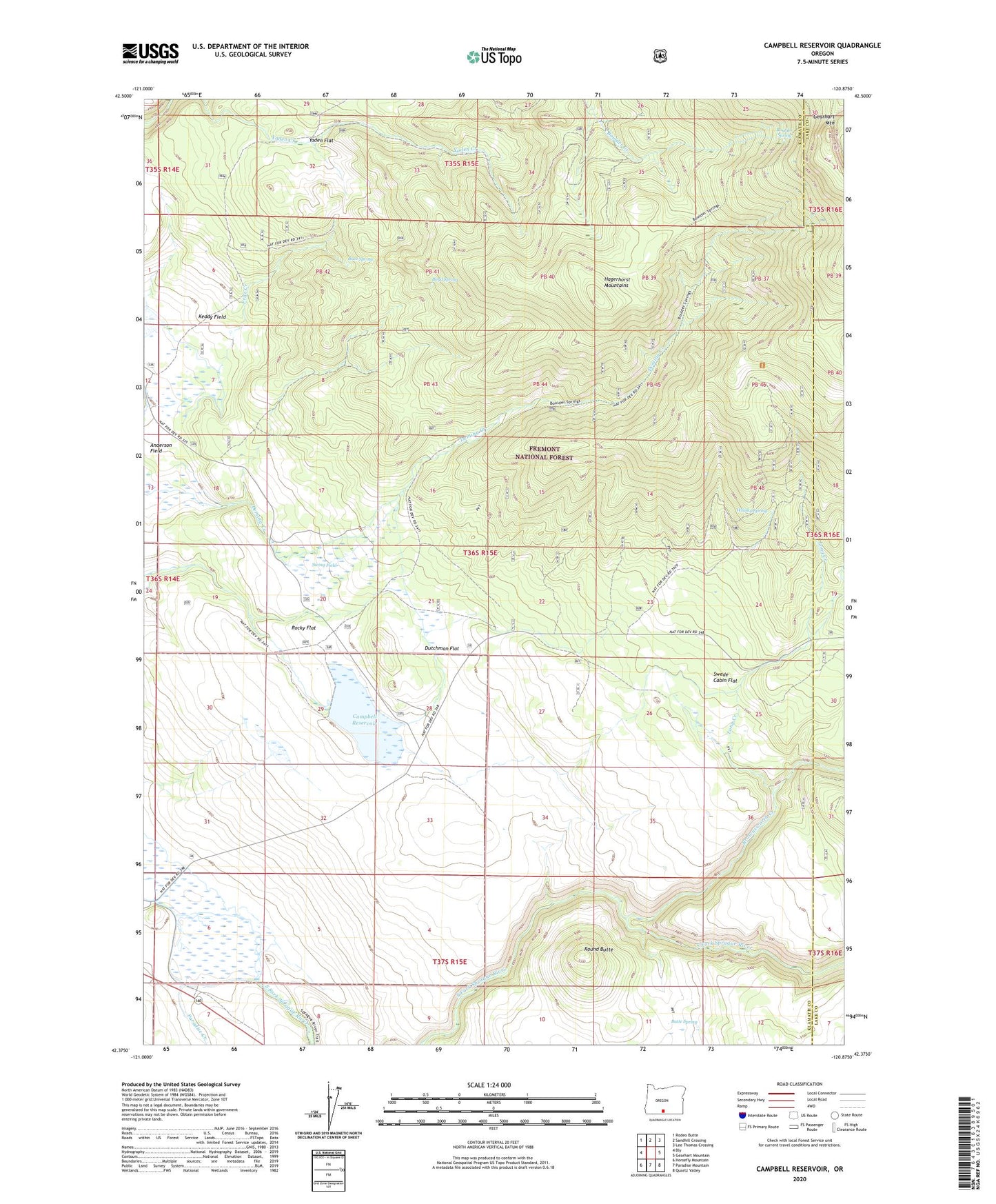
Campbell Reservoir Oregon US Topo Map
Couldn't load pickup availability
Also explore the Campbell Reservoir Forest Service Topo of this same quad for updated USFS data
2023 topographic map quadrangle Campbell Reservoir in the state of Oregon. Scale: 1:24000. Based on the newly updated USGS 7.5' US Topo map series, this map is in the following counties: Klamath, Lake. The map contains contour data, water features, and other items you are used to seeing on USGS maps, but also has updated roads and other features. This is the next generation of topographic maps. Printed on high-quality waterproof paper with UV fade-resistant inks.
Quads adjacent to this one:
West: Bly
Northwest: Rodeo Butte
North: Sandhill Crossing
Northeast: Lee Thomas Crossing
East: Gearhart Mountain
Southeast: Quartz Valley
South: Paradise Mountain
Southwest: Horsefly Mountain
This map covers the same area as the classic USGS quad with code o42120d8.
Contains the following named places: Anderson Field, Boulder Spring, Boulder Spring Trail, Boyd Spring, Brownsworth Creek, Butte Spring, Buzz Spring, Campbell Dam, Campbell Reservoir, Deming Creek Trailhead, Dutchman Flat, Gayheart Slough, Gearhart Mountain, Hagerhorst Mountains, Keddy Field, Long Creek, Paddock Camp, Paradise Creek, Rocky Flat, Round Butte, Seven C Ranch, Swede Cabin, Swede Cabin Flat, Swing Field, Whisky Spring, Whisky Spring Trail, Yaden Flat