MyTopo
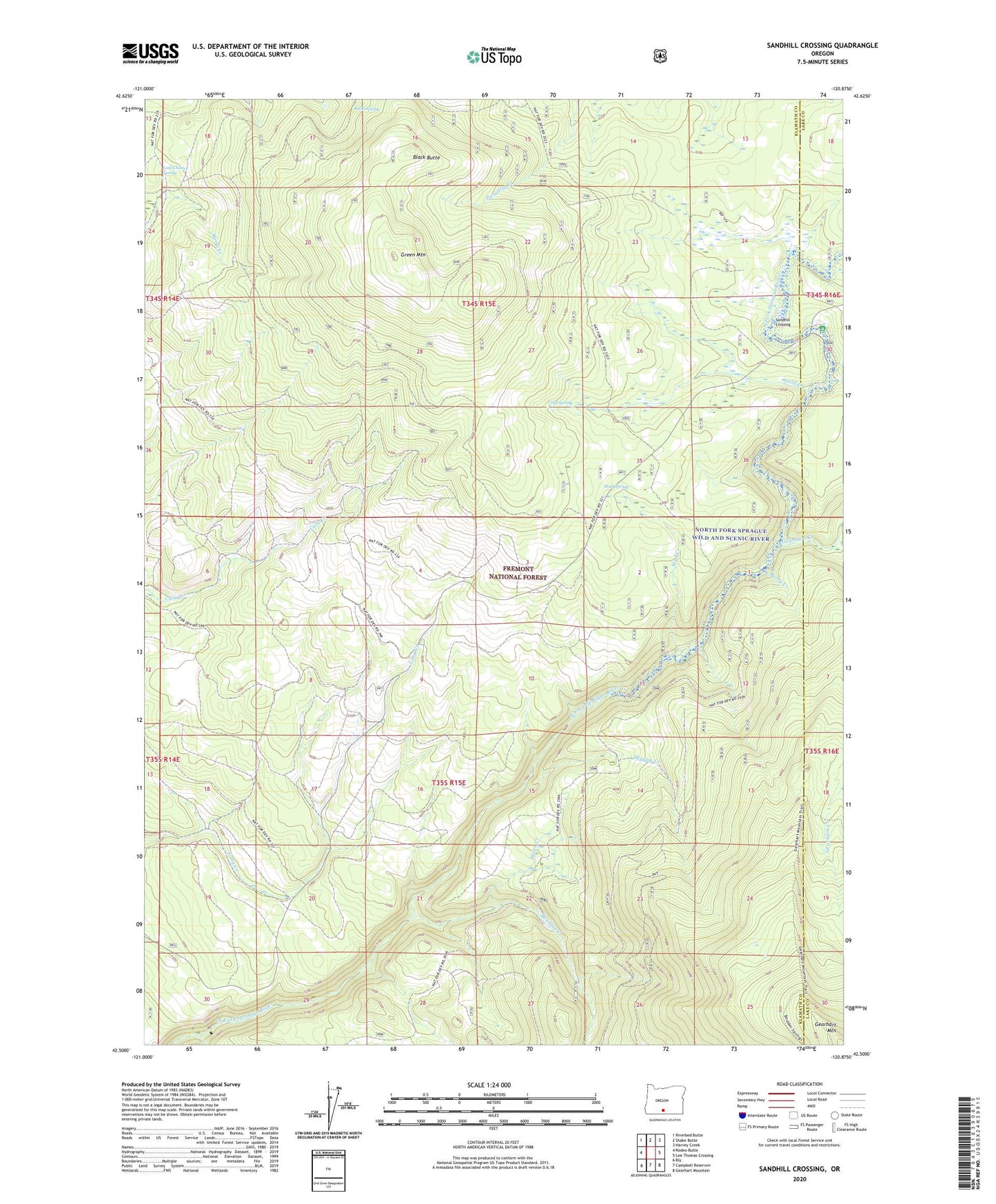
Sandhill Crossing Oregon US Topo Map
Couldn't load pickup availability
Also explore the Sandhill Crossing Forest Service Topo of this same quad for updated USFS data
2023 topographic map quadrangle Sandhill Crossing in the state of Oregon. Scale: 1:24000. Based on the newly updated USGS 7.5' US Topo map series, this map is in the following counties: Klamath, Lake. The map contains contour data, water features, and other items you are used to seeing on USGS maps, but also has updated roads and other features. This is the next generation of topographic maps. Printed on high-quality waterproof paper with UV fade-resistant inks.
Quads adjacent to this one:
West: Rodeo Butte
Northwest: Riverbed Butte
North: Shake Butte
Northeast: Harvey Creek
East: Lee Thomas Crossing
Southeast: Gearhart Mountain
South: Campbell Reservoir
Southwest: Bly
This map covers the same area as the classic USGS quad with code o42120e8.
Contains the following named places: B K Corral, Berry Creek, Black Butte, Book Spring, Boulder Creek, Cold Creek, Cold Spring, Conrad Place, Dixon Creek, Fremont National Forest, Gearhart Creek, Gearhart Trail, Green Mountain, Last Chance Spring, Mud Creek, Mud Spring, Ryan Cabin, Sandhill Crossing, Sandhill Recreation Site, Sheepy Creek, Yaden Creek