MyTopo
Paradise Mountain Oregon US Topo Map
Couldn't load pickup availability
Also explore the Paradise Mountain Forest Service Topo of this same quad for updated USFS data
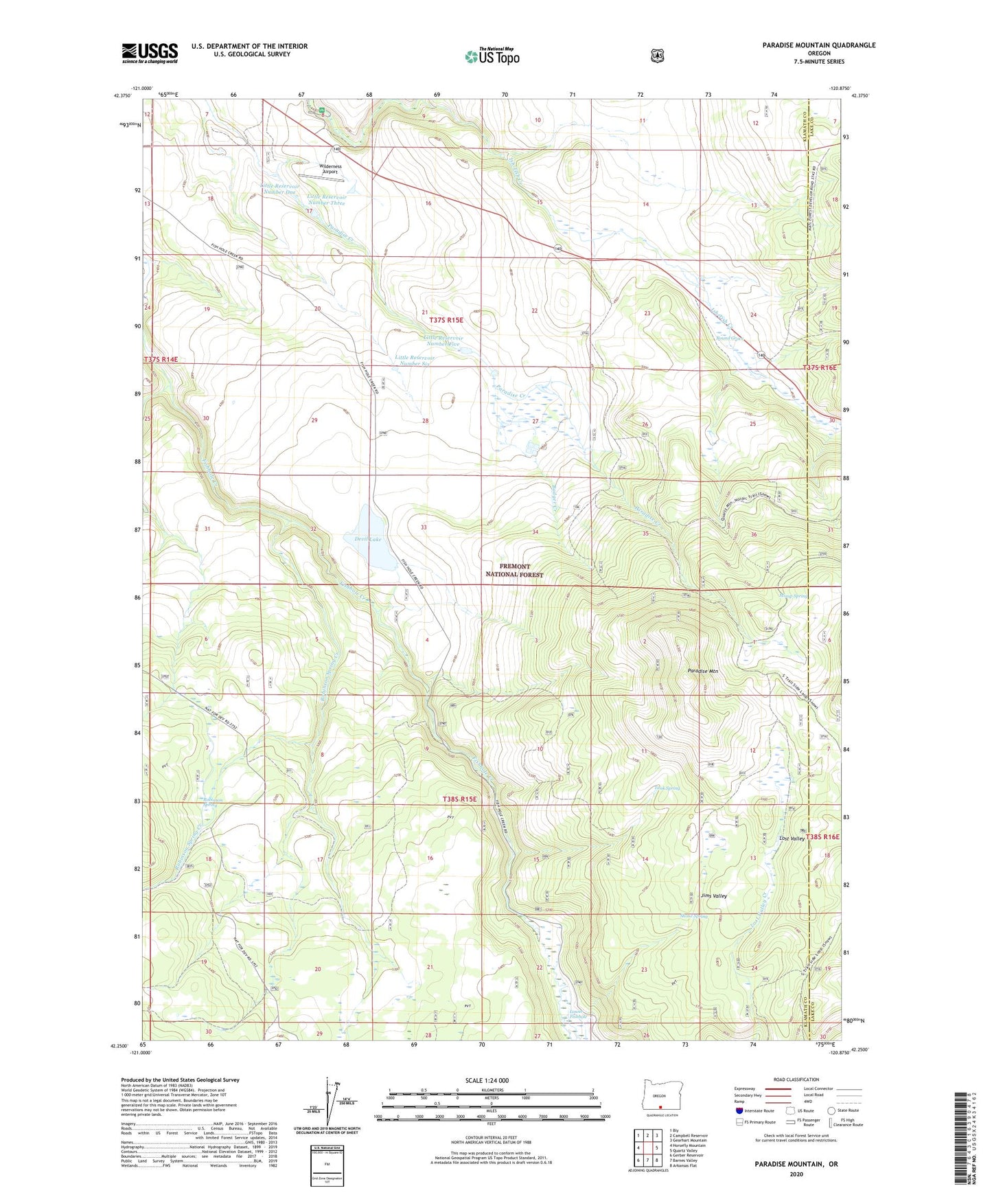
2023 topographic map quadrangle Paradise Mountain in the state of Oregon. Scale: 1:24000. Based on the newly updated USGS 7.5' US Topo map series, this map is in the following counties: Klamath, Lake. The map contains contour data, water features, and other items you are used to seeing on USGS maps, but also has updated roads and other features. This is the next generation of topographic maps. Printed on high-quality waterproof paper with UV fade-resistant inks.
Quads adjacent to this one:
West: Horsefly Mountain
Northwest: Bly
North: Campbell Reservoir
Northeast: Gearhart Mountain
East: Quartz Valley
Southeast: Arkansas Flat
South: Barnes Valley
Southwest: Gerber Reservoir
This map covers the same area as the classic USGS quad with code o42120c8.
Contains the following named places: Badger Creek, Casebeer Ranch, Devil Lake, Devils Garden, Ish Tish Creek, Jims Valley, Little Reservoir Number Five, Little Reservoir Number One, Little Reservoir Number Six, Little Reservoir Number Three, Lost Valley, Mixup Spring, Paradise Mountain, Paradise Ranch, Robinson Spring, Robinson Spring Creek, Round Grove, Round Grove Ranch, Round Grove Weather Station, Shone Spring, Sprague River Park Recreation Site, Tank Spring, Wilderness Airport