MyTopo
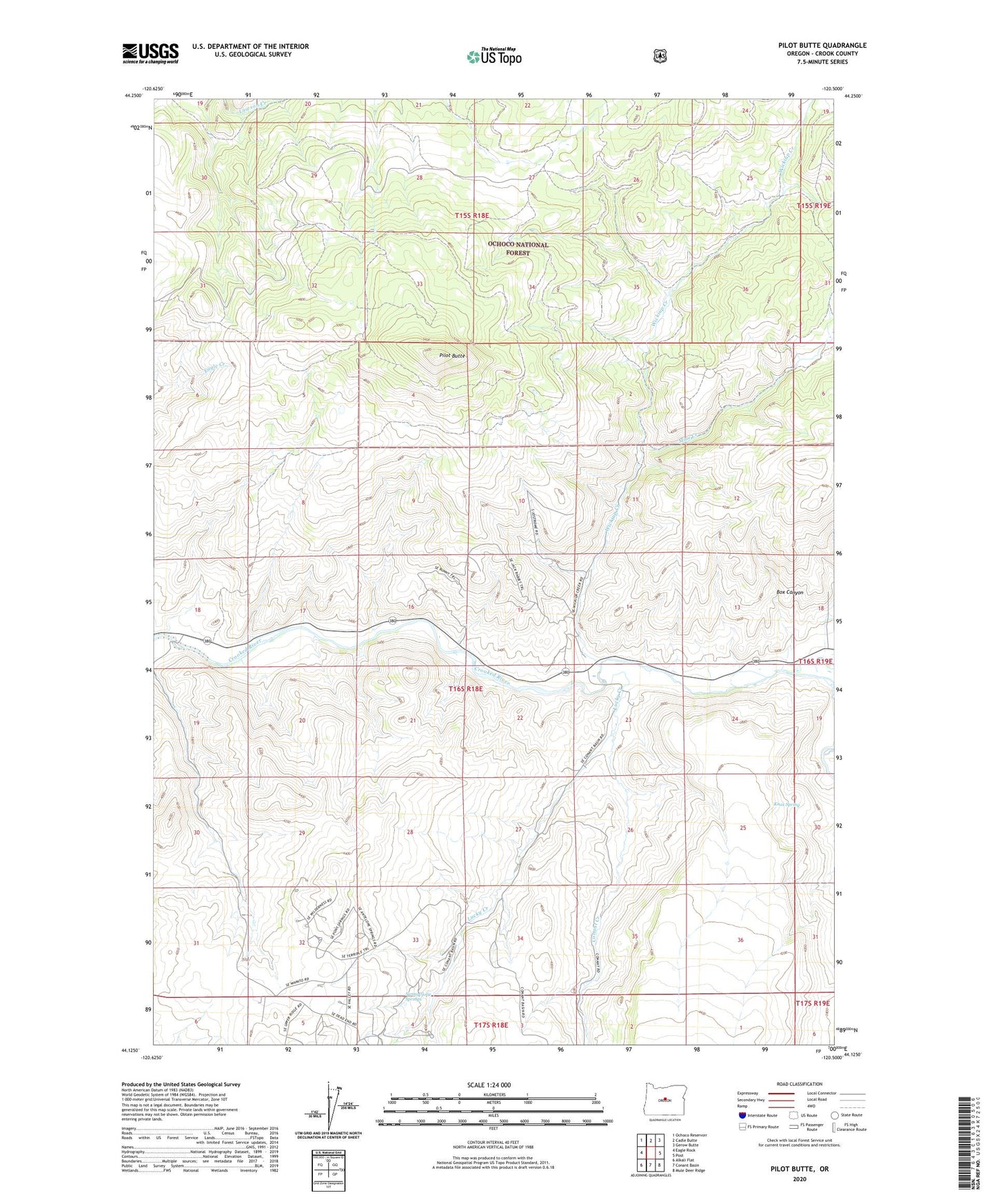
Pilot Butte Oregon US Topo Map
Couldn't load pickup availability
Also explore the Pilot Butte Forest Service Topo of this same quad for updated USFS data
2024 topographic map quadrangle Pilot Butte in the state of Oregon. Scale: 1:24000. Based on the newly updated USGS 7.5' US Topo map series, this map is in the following counties: Crook. The map contains contour data, water features, and other items you are used to seeing on USGS maps, but also has updated roads and other features. This is the next generation of topographic maps. Printed on high-quality waterproof paper with UV fade-resistant inks.
Quads adjacent to this one:
West: Eagle Rock
Northwest: Ochoco Reservoir
North: Cadle Butte
Northeast: Gerow Butte
East: Post
Southeast: Mule Deer Ridge
South: Conant Basin
Southwest: Alkali Flat
This map covers the same area as the classic USGS quad with code o44120b5.
Contains the following named places: Box Canyon, Conant Creek, Knox Spring, Lucky Creek, Mule Creek, Pilot Butte, Porfily Ranch, Prineville Reservoir State Park, Riverside Ranch, Shorty Davis Ranch, Sunny Slope Springs, Wickiup Creek, ZIP Code: 97754