
MyTopo
Gibbon Oregon US Topo Map
Couldn't load pickup availability
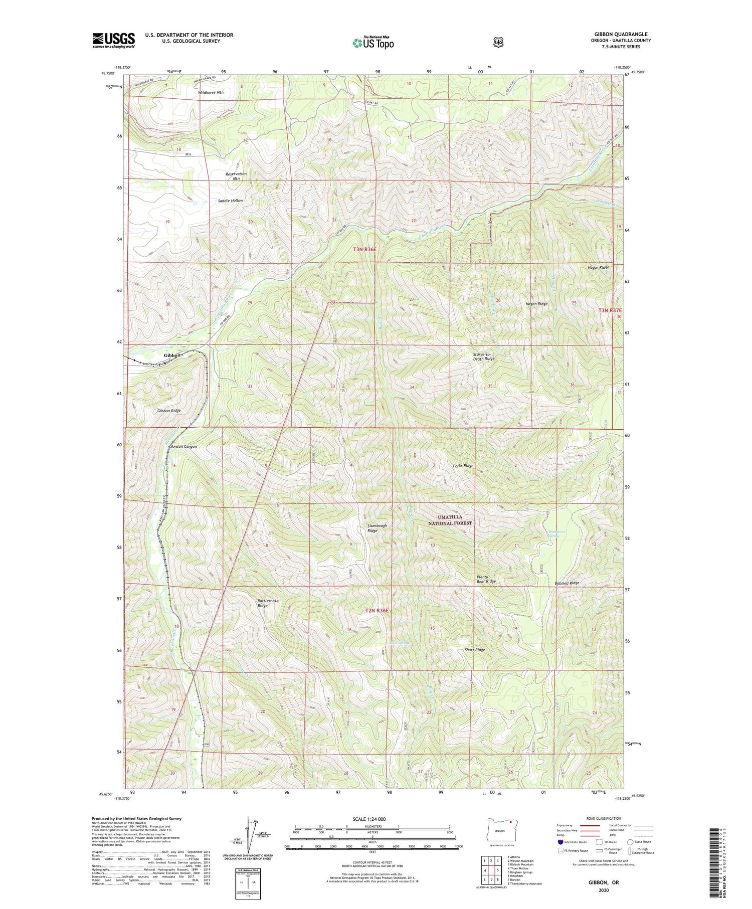
2020 topographic map quadrangle Gibbon in the state of Oregon. Scale: 1:24000. Based on the newly updated USGS 7.5' US Topo map series, this map is in the following counties: Umatilla. The map contains contour data, water features, and other items you are used to seeing on USGS maps, but also has updated roads and other features. This is the next generation of topographic maps. Printed on high-quality waterproof paper with UV fade-resistant inks.
Quads adjacent to this one:
West: Thorn Hollow
Northwest: Athena
North: Weston Mountain
Northeast: Blalock Mountain
East: Bingham Springs
Southeast: Thimbleberry Mountain
South: Duncan
Southwest: Meacham
Contains the following named places: Bobsled Creek, Bobsled Ridge, Bonifer, Boston Canyon, Conway, Forks Ridge, Gibbon, Gibbon Post Office, Hagar Creek, Hagar Ridge, Hagen Creek, Hagen Ridge, Line Creek, Meacham Creek, Mikecha, Plenty Bear Ridge, Rattlesnake Ridge, Reservation Mountain, Rock Spring, Ryan Creek, Short Ridge, Starve-to-Death Ridge, Stumbough Ridge, Thompson Spring


