MyTopo
Athena Oregon US Topo Map
Couldn't load pickup availability
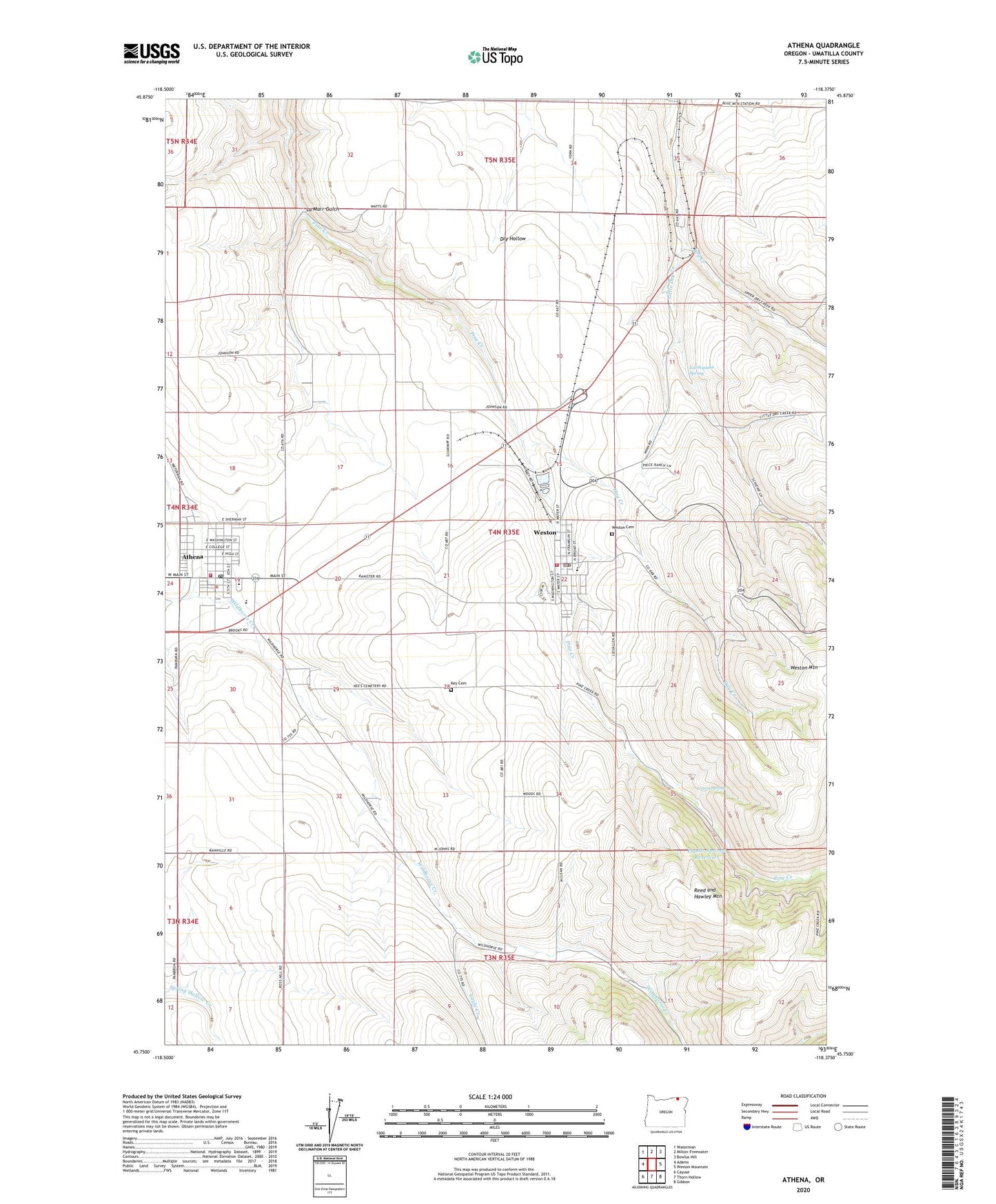
2023 topographic map quadrangle Athena in the state of Oregon. Scale: 1:24000. Based on the newly updated USGS 7.5' US Topo map series, this map is in the following counties: Umatilla. The map contains contour data, water features, and other items you are used to seeing on USGS maps, but also has updated roads and other features. This is the next generation of topographic maps. Printed on high-quality waterproof paper with UV fade-resistant inks.
Quads adjacent to this one:
West: Adams
Northwest: Waterman
North: Milton-Freewater
Northeast: Bowlus Hill
East: Weston Mountain
Southeast: Gibbon
South: Thorn Hollow
Southwest: Cayuse
This map covers the same area as the classic USGS quad with code o45118g4.
Contains the following named places: Athena, Athena City Hall, Athena City Park, Athena Elementary School, Athena Memorial Ball Park, Athena Municipal Court, Athena Police Department, Athena Post Office, Athena Public Library, Athena Public Works Department, Athena Volunteer Fire Department, Athena Wastewater Treatment Plant, Barrett Field Airport, Blue Mountain, City of Athena, City of Weston, Downing, Duggor Park, Eagle Creek, Earthquake Spring, East Umatilla County Health District, East Umatilla County Rural Fire Protection District Station 1 Headquarters, Elliott Memorial Park, Green Spring, Hay Creek, Key Cemetery, La Marr Gulch, Little Dry Creek, Poplar Springs Dam, Poplar Springs Reservoir, Weston, Weston - McEwen High School, Weston Cemetery, Weston City Hall, Weston Middle School, Weston Police Department, Weston Post Office, Weston Public Library, Weston Station, Weston Wastewater Treatment Plant