MyTopo
Glass Buttes Oregon US Topo Map
Couldn't load pickup availability
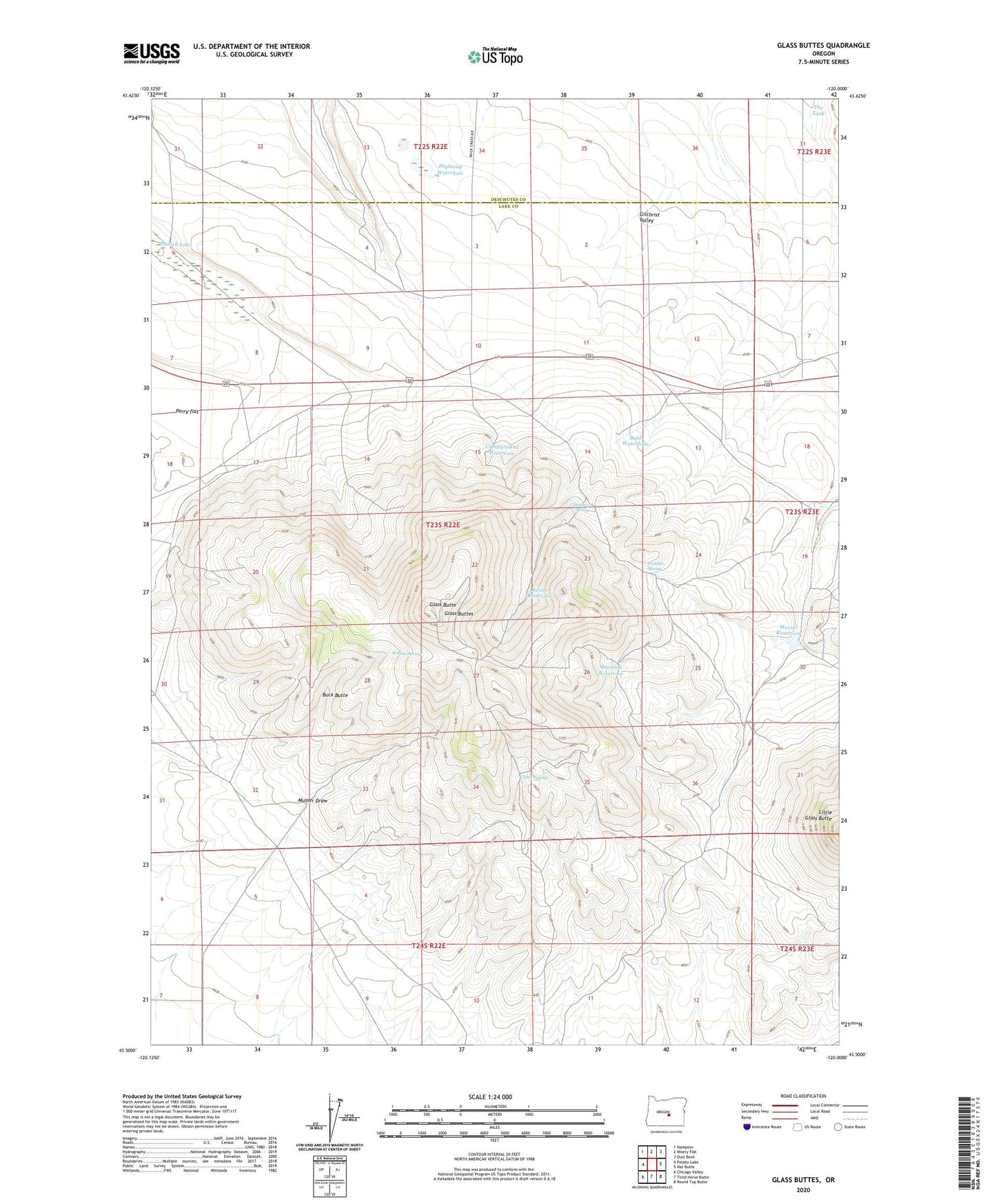
2023 topographic map quadrangle Glass Buttes in the state of Oregon. Scale: 1:24000. Based on the newly updated USGS 7.5' US Topo map series, this map is in the following counties: Lake, Deschutes. The map contains contour data, water features, and other items you are used to seeing on USGS maps, but also has updated roads and other features. This is the next generation of topographic maps. Printed on high-quality waterproof paper with UV fade-resistant inks.
Quads adjacent to this one:
West: Potato Lake
Northwest: Hampton
North: Misery Flat
Northeast: Dust Bowl
East: Hat Butte
Southeast: Round Top Butte
South: Tired Horse Butte
Southwest: Chicago Valley
Contains the following named places: Bald Waterhole, Buck Butte, Cabin Spring, Campground Reservoir, Chesebro Spring, Dribble Spring, Glass Butte, Glass Buttes, Highway Waterhole, Musser Draw, Musser Reservoir, Musser Well, Pausch Lake, Perry flat, Question Reservoir, Robins Spring, Swale Reservoir, The Tank, Whipple Place