MyTopo
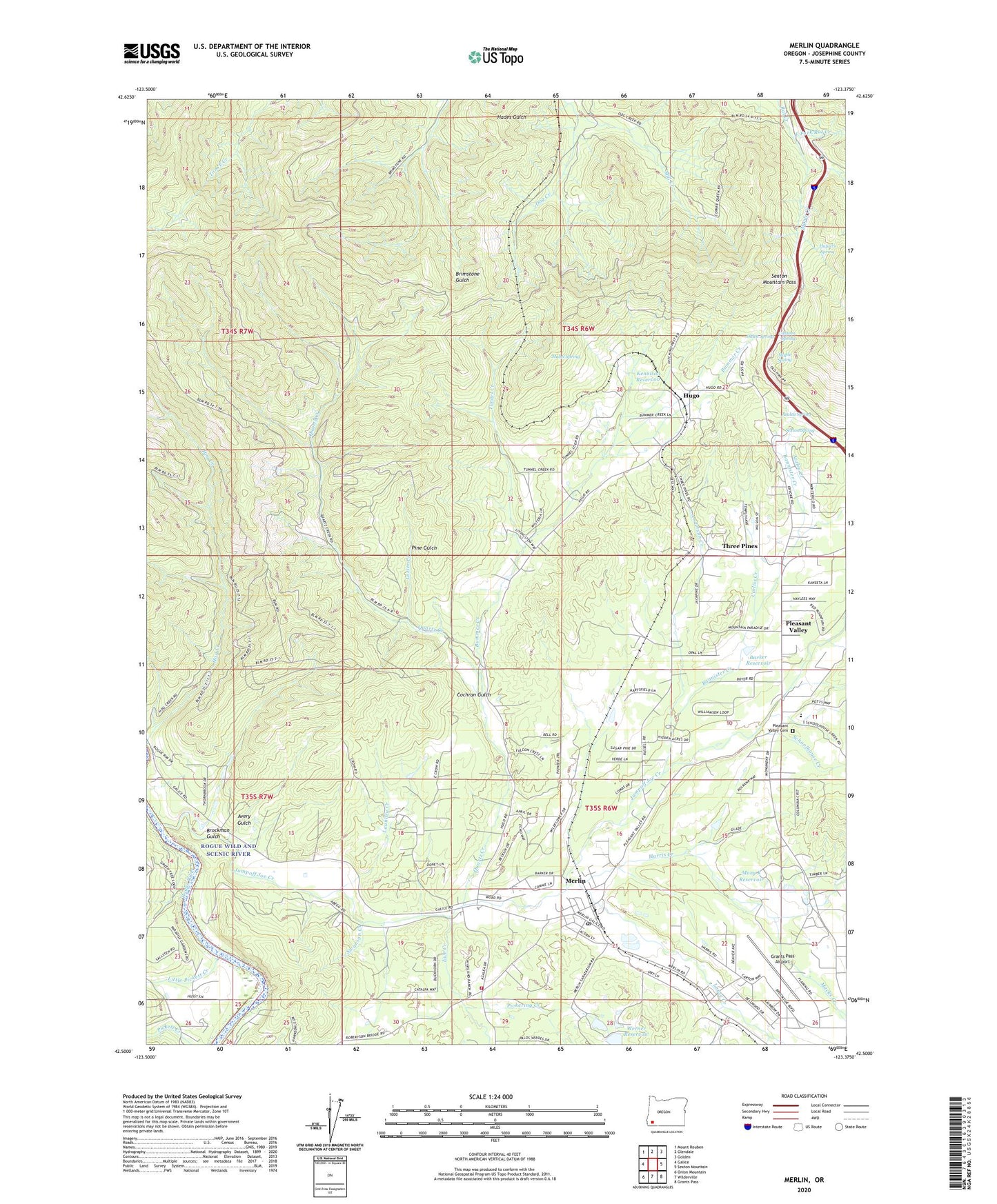
Merlin Oregon US Topo Map
Couldn't load pickup availability
Also explore the Merlin Forest Service Topo of this same quad for updated USFS data
2023 topographic map quadrangle Merlin in the state of Oregon. Scale: 1:24000. Based on the newly updated USGS 7.5' US Topo map series, this map is in the following counties: Josephine. The map contains contour data, water features, and other items you are used to seeing on USGS maps, but also has updated roads and other features. This is the next generation of topographic maps. Printed on high-quality waterproof paper with UV fade-resistant inks.
Quads adjacent to this one:
West: Galice
Northwest: Mount Reuben
North: Glendale
Northeast: Golden
East: Sexton Mountain
Southeast: Grants Pass
South: Wilderville
Southwest: Onion Mountain
This map covers the same area as the classic USGS quad with code o42123e4.
Contains the following named places: Anderson Creek, Antler Creek, Avery Gulch, Azalea Creek, Azalea Spring, Bannister Creek, Barker Reservoir, Brockman Gulch, Bummer Creek, Canteen Spring, Cochran Gulch, Copper Queen Mine, East Fork Rat Creek, Engler Huson Dike, Ewe Creek, Grants Pass Airport, Harris Creek, Heffling, Hugo, Hugo Post Office, Huylers Spring, Josephine, Josephine County School District Sewage Treatment Plant, Jumpoff Joe Creek, Kennison Reservoir, Kenny, Little Pickett Creek, Louse Creek, Lozier Creek, Mabel Spring, Macks Creek, Maple Creek, Maple Spring, Mary K Reservoir, McAllister Post Office, Merlin, Merlin Census Designated Place, Merlin Post Office, Merlin Sanitarium, Mill Creek, Mount Sexton Intermediate School, Olden Spring, Pickering Creek, Pine Gulch, Pleasant Valley, Pleasant Valley Cemetery, Pottsville Museum and Pioneer Town, Quartz Creek, Rogue River Scenic Waterway, Rural / Metro Fire Department Station 5, Salt Lick Creek, Sanders Gulch, Schoolhouse Creek, Sexton Mountain Pass, Sexton Spring, Swanson Creek, Three Pines, Threepines Post Office, Tunnel 9, Tunnel Creek, Vineyard Christian School, Walker Creek, Werner Reservoir