MyTopo
Green Mountain Oregon US Topo Map
Couldn't load pickup availability
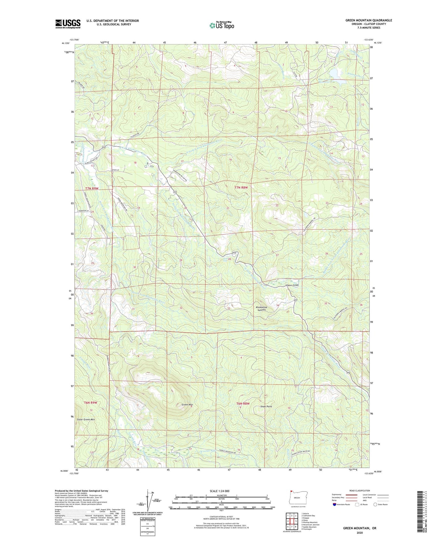
2020 topographic map quadrangle Green Mountain in the state of Oregon. Scale: 1:24000. Based on the newly updated USGS 7.5' US Topo map series, this map is in the following counties: Clatsop. The map contains contour data, water features, and other items you are used to seeing on USGS maps, but also has updated roads and other features. This is the next generation of topographic maps. Printed on high-quality waterproof paper with UV fade-resistant inks.
Quads adjacent to this one:
West: Olney
Northwest: Astoria
North: Cathlamet Bay
Northeast: Knappa
East: Wickiup Mountain
Southeast: Vinemaple
South: Saddle Mountain
Southwest: Necanicum Junction
Contains the following named places: Astoria Water Treatment Plant, Barth Falls, Bear Creek Dam, Bear Creek Reservoir, Clatsop County, Estoos, Fox Creek, Glazers Grade, Green Mountain, John Day Creek, Klaskanine Fish Hatchery, Klaskanine Summit, Lilleas, Middle Fork North Fork Klaskanine River, Nobel Ridge Farm, North Fork Klaskanine River, North Fork North Fork Klaskanine River, Olney G S, Osgood Creek, Perkins Creek, Rock Creek, Sigfredson County Park, Snow Point, South Fork Klaskanine River, South Fork Youngs River, Waterworks Creek