MyTopo
Rawhide Pocket Oregon US Topo Map
Couldn't load pickup availability
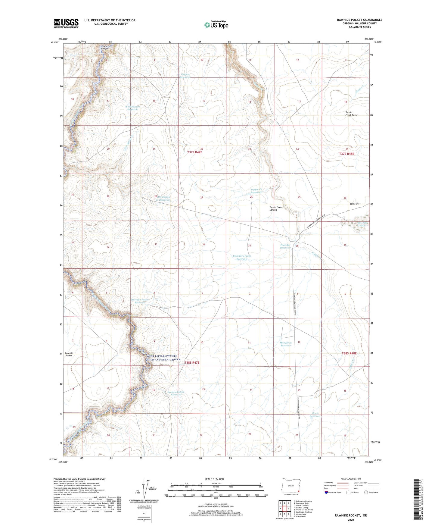
2024 topographic map quadrangle Rawhide Pocket in the state of Oregon. Scale: 1:24000. Based on the newly updated USGS 7.5' US Topo map series, this map is in the following counties: Malheur. The map contains contour data, water features, and other items you are used to seeing on USGS maps, but also has updated roads and other features. This is the next generation of topographic maps. Printed on high-quality waterproof paper with UV fade-resistant inks.
Quads adjacent to this one:
West: Rawhide Springs
Northwest: No Crossing Crossing
North: Drummond Basin
Northeast: Deacon Crossing
East: Beaver Charlie Breaks
Southeast: Defeat Butte
South: Stoney Corral
Southwest: Guadalupe Meadows
This map covers the same area as the classic USGS quad with code o42117c2.
Contains the following named places: Boundary Fence Reservoir, Bull Flat Lake, Canyon Reservoir, Harvey Cracker Reservoir, Little Spring Creek Reservoir, Manydraw Reservoir, Pack Rat Reservoir, Road Reservoir, Section Sixteen Reservoir, Toppin Creek Butte, Toppin Creek Reservoir, West Pasture Reservoir