MyTopo
Hardman Oregon US Topo Map
Couldn't load pickup availability
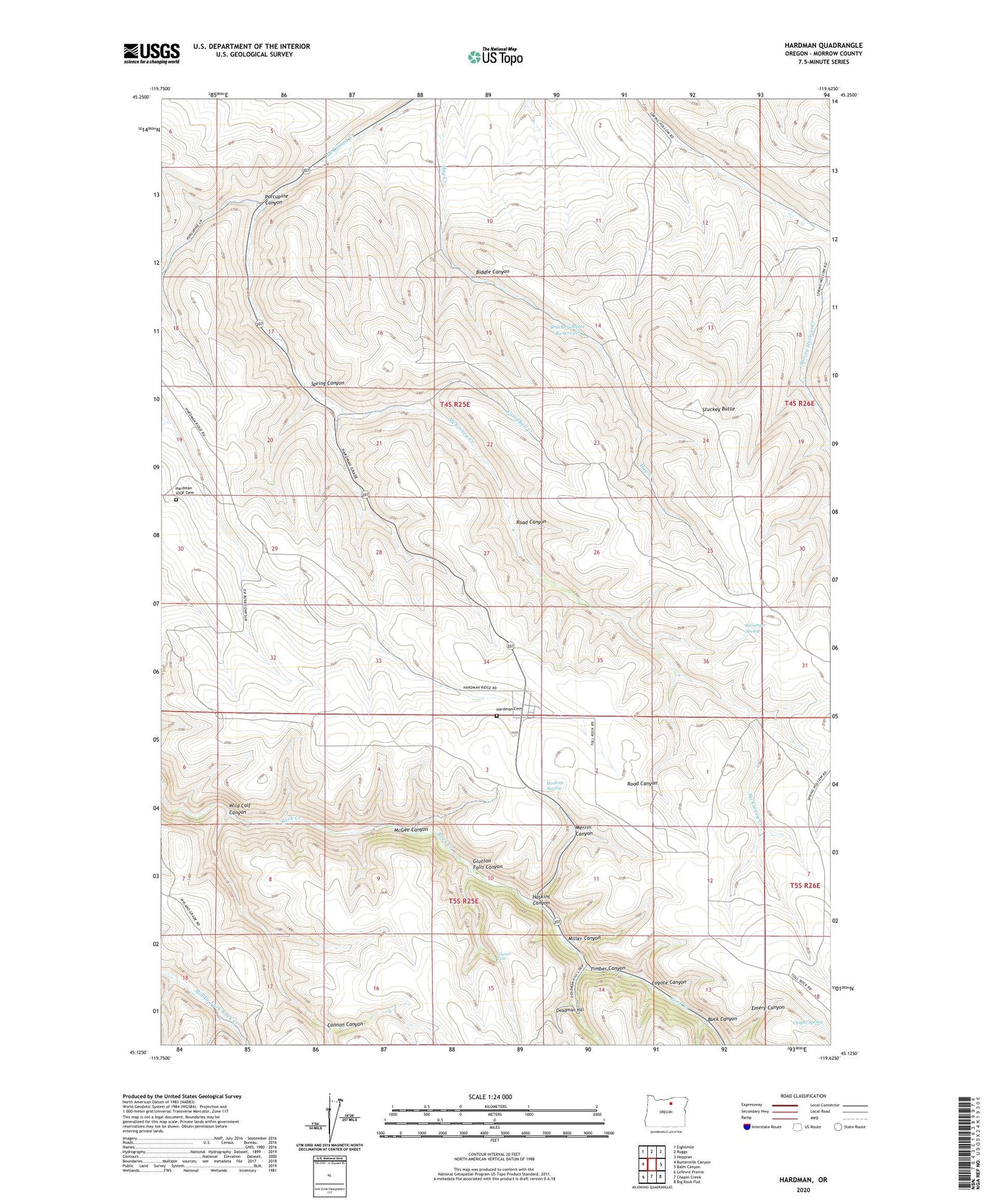
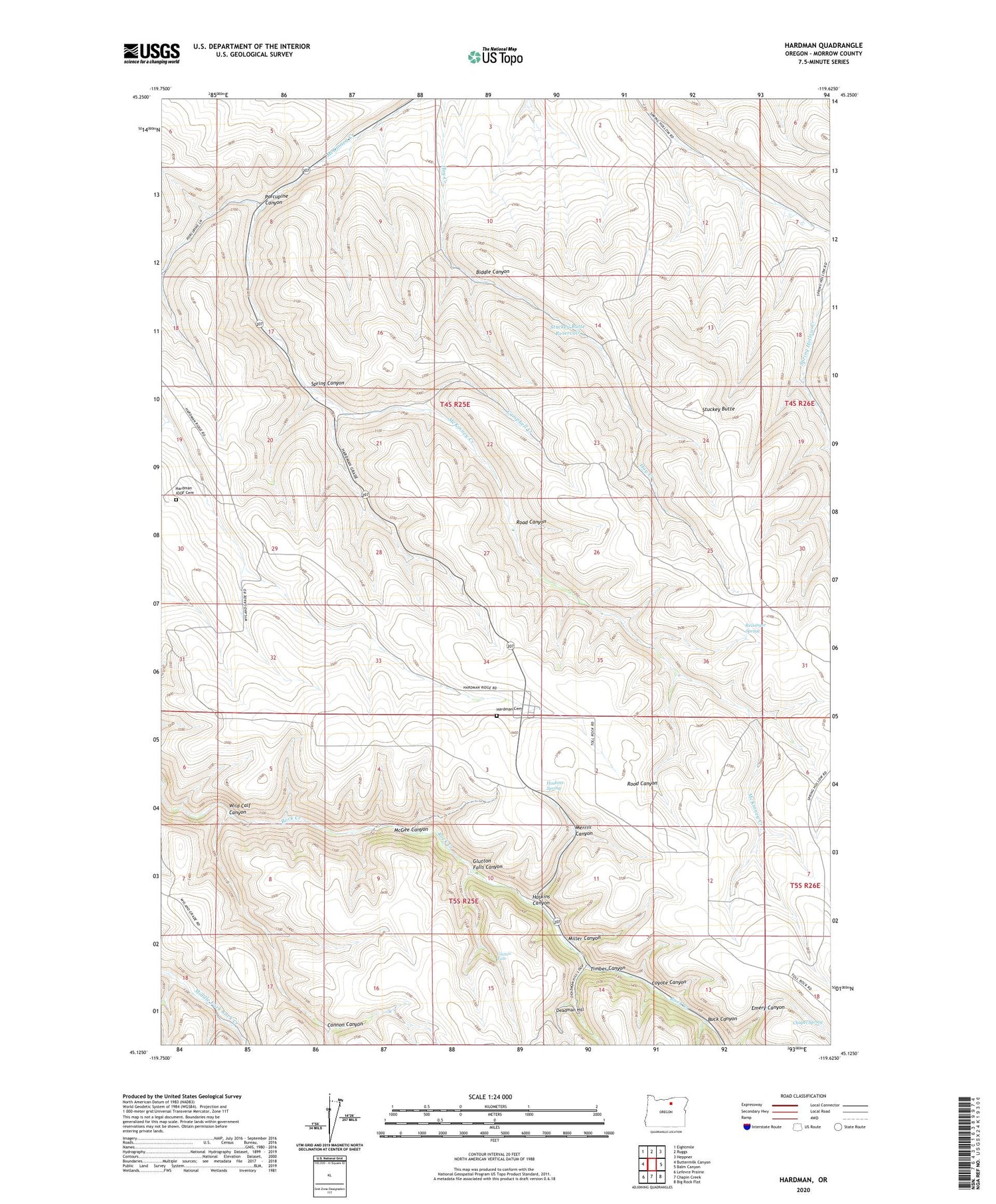
2020 topographic map quadrangle Hardman in the state of Oregon. Scale: 1:24000. Based on the newly updated USGS 7.5' US Topo map series, this map is in the following counties: Morrow. The map contains contour data, water features, and other items you are used to seeing on USGS maps, but also has updated roads and other features. This is the next generation of topographic maps. Printed on high-quality waterproof paper with UV fade-resistant inks.
Quads adjacent to this one:
West: Buttermilk Canyon
Northwest: Eightmile
North: Ruggs
Northeast: Heppner
East: Balm Canyon
Southeast: Big Rock Flat
South: Chapin Creek
Southwest: Lefevre Prairie
Contains the following named places: Adamsville Post Office, Biddle Canyon, Buck Canyon, Campbell Creek, Cannon Canyon, Chapel Spring, Coyote Canyon, Deadman Hill, Glutton Falls, Glutton Falls Canyon, Hardman, Hardman Cemetery, Hardman IOOF Cemetery, Hardman Post Office, Hoskins Canyon, Hoskins Spring, McGee Canyon, Merrill Canyon, Miller Canyon, Porcupine Canyon, Reininger Spring, Road Canyon, Spring Canyon, Stuckey Butte, Stuckey Butte Reservoir, Timber Canyon, Wild Calf Canyon