MyTopo
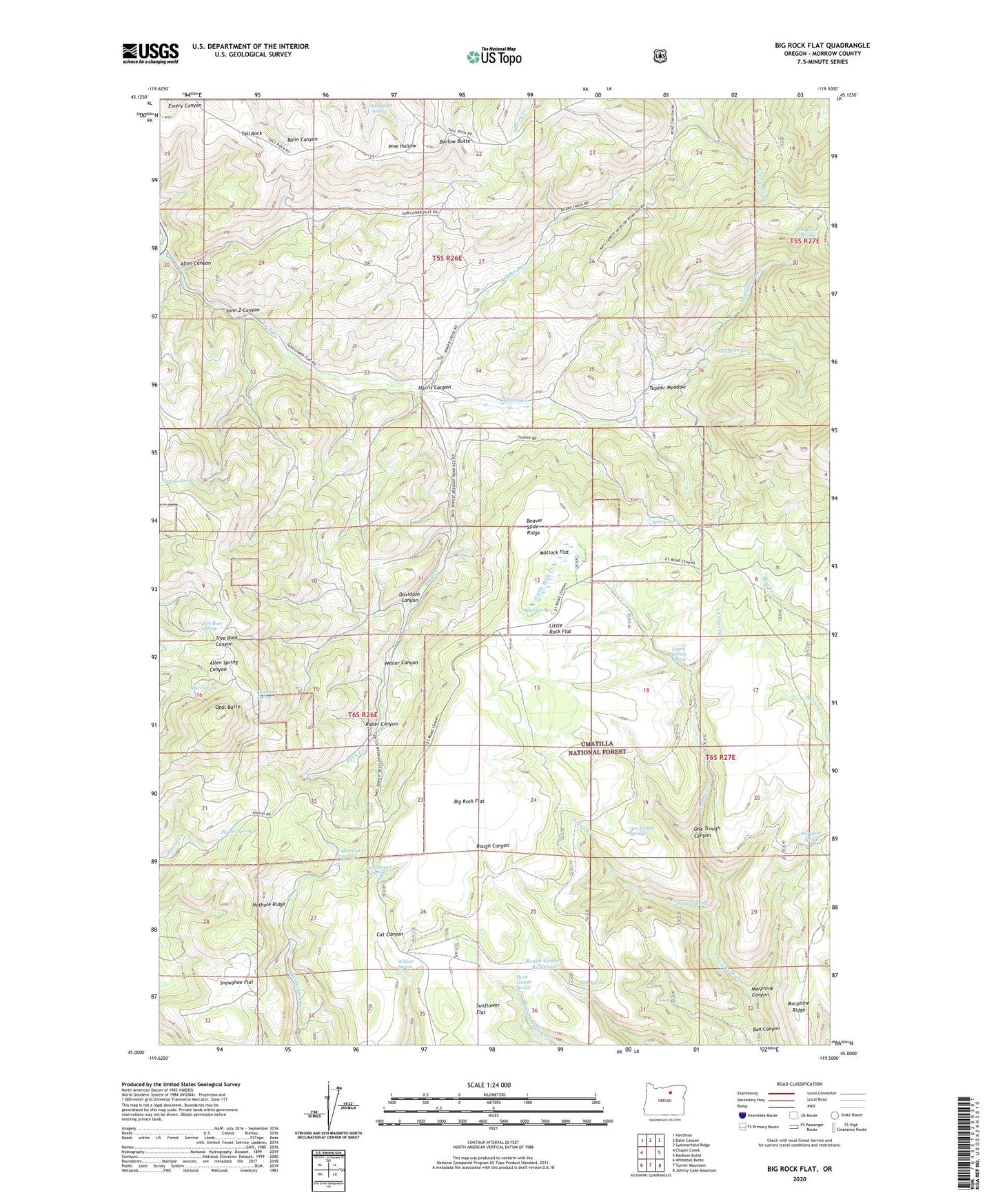
Big Rock Flat Oregon US Topo Map
Couldn't load pickup availability
Also explore the Big Rock Flat Forest Service Topo of this same quad for updated USFS data
2024 topographic map quadrangle Big Rock Flat in the state of Oregon. Scale: 1:24000. Based on the newly updated USGS 7.5' US Topo map series, this map is in the following counties: Morrow. The map contains contour data, water features, and other items you are used to seeing on USGS maps, but also has updated roads and other features. This is the next generation of topographic maps. Printed on high-quality waterproof paper with UV fade-resistant inks.
Quads adjacent to this one:
West: Chapin Creek
Northwest: Hardman
North: Balm Canyon
Northeast: Summerfield Ridge
East: Madison Butte
Southeast: Johnny Cake Mountain
South: Turner Mountain
Southwest: Whitetail Butte
This map covers the same area as the classic USGS quad with code o45119a5.
Contains the following named places: Allen Canyon, Allen Spring, Anson Wright Memorial Park, Aspen Creek, Aspen Spring, Barlow Butte, Beaver Slide Ridge, Big Flat Airstrip, Big Rock Flat, Bleakman Spring, Board Creek, Box Canyon, Chapin Creek, Chickadee Spring, Davidson Canyon, Government Spring, Harrington Spring, Harris Canyon, Hollywood Creek, Hollywood Spring, Hothole Ridge, John Z Canyon, Keeney Creek, Little Rock Flat, Matlock Flat, Matlock Spring, Morphine Canyon, Morphine Ridge, Morphine Spring, One Trough Canyon, One Trough Spring, Opal Butte, Opal Spring, Parkers Mill, Parkers Mills Post Office, Raber Canyon, Reeds Mill, Rough Canyon Reservoir, Shaner Spring, Sicklebar Spring, Snowshoe Flat, SOB Spring, Sperry Spring, Sunflower Flat, Three Trough Spring, Toll Rock, Tree Root Spring, Tupper Corral, Tupper Creek, Tupper Meadow, Upper Keeney Spring, Wesler Canyon, Wildcat Spring