MyTopo
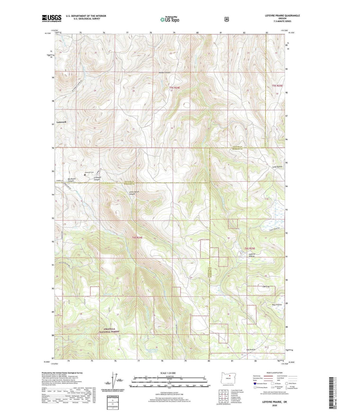
Lefevre Prairie Oregon US Topo Map
Couldn't load pickup availability
Also explore the Lefevre Prairie Forest Service Topo of this same quad for updated USFS data
2024 topographic map quadrangle Lefevre Prairie in the state of Oregon. Scale: 1:24000. Based on the newly updated USGS 7.5' US Topo map series, this map is in the following counties: Gilliam, Wheeler, Morrow. The map contains contour data, water features, and other items you are used to seeing on USGS maps, but also has updated roads and other features. This is the next generation of topographic maps. Printed on high-quality waterproof paper with UV fade-resistant inks.
Quads adjacent to this one:
West: Lonerock
Northwest: Lone Rock Creek
North: Buttermilk Canyon
Northeast: Hardman
East: Chapin Creek
Southeast: Whitetail Butte
South: Collins Butte
Southwest: Wheeler Point
This map covers the same area as the classic USGS quad with code o45119a7.
Contains the following named places: Big Dutch Canyon, Brandenburg Reservoir, Crishook Canyon, Dry Fork Brown Creek, Lee Prairie, Lefevre Prairie, Little Dutch Canyon, Lonerock Cemetery, Perry Spring, Pullen Canyon, Scot Prairie, The Frog