MyTopo
Hawks Mountain Oregon US Topo Map
Couldn't load pickup availability
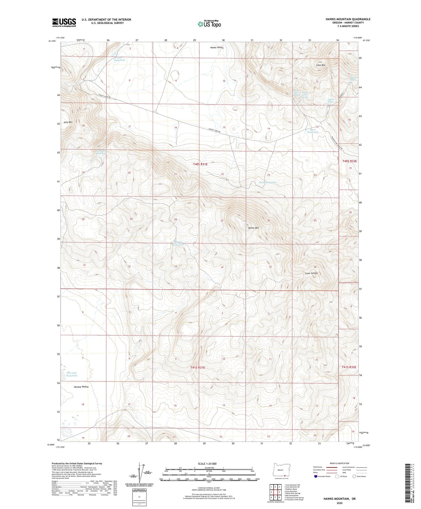
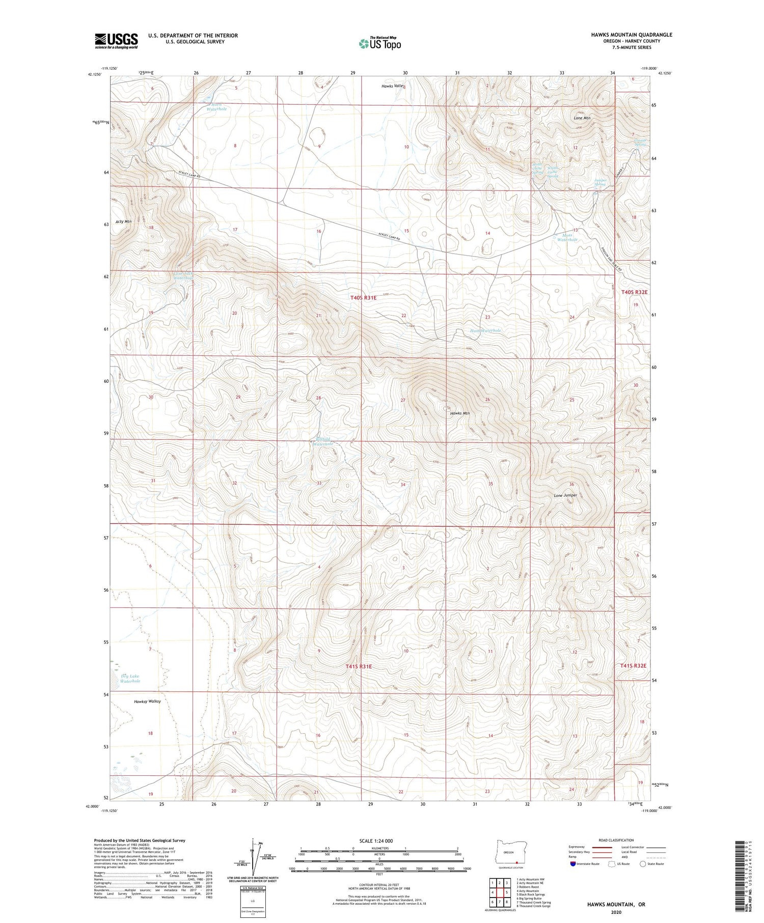
2023 topographic map quadrangle Hawks Mountain in the state of Oregon. Scale: 1:24000. Based on the newly updated USGS 7.5' US Topo map series, this map is in the following counties: Harney. The map contains contour data, water features, and other items you are used to seeing on USGS maps, but also has updated roads and other features. This is the next generation of topographic maps. Printed on high-quality waterproof paper with UV fade-resistant inks.
Quads adjacent to this one:
West: Acty Mountain
Northwest: Acty Mountain NW
North: Acty Mountain NE
Northeast: Robbers Roost
East: Black Rock Springs
Southeast: Thousand Creek Gorge
South: Thousand Creek Spring
Southwest: Big Spring Butte
This map covers the same area as the classic USGS quad with code o42119a1.
Contains the following named places: Acty Cow Camp, Billfold Waterhole, Dry Lake Waterhole, Granite Spring, Ham Waterhole, Hawks Mountain, Hawks Valley, Hawks Valley Airstrip, Horn Waterhole, Juniper Spring, Lone Jack Waterhole, Lone Juniper, Moss Waterhole, Scotts Cache, Scotts Cache Spring, Whitts Cache Spring