MyTopo
Hehe Butte Oregon US Topo Map
Couldn't load pickup availability
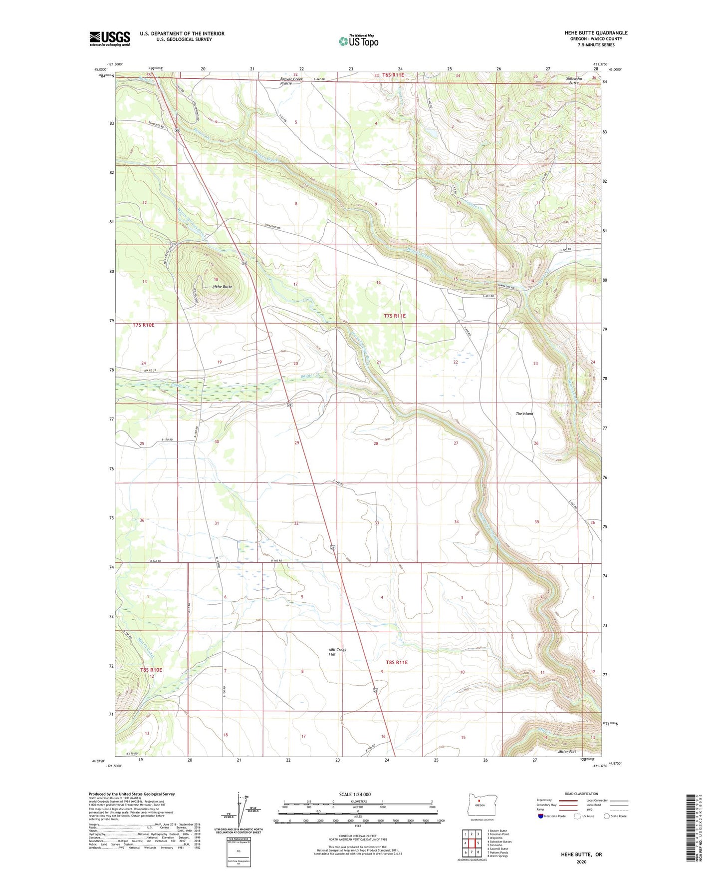
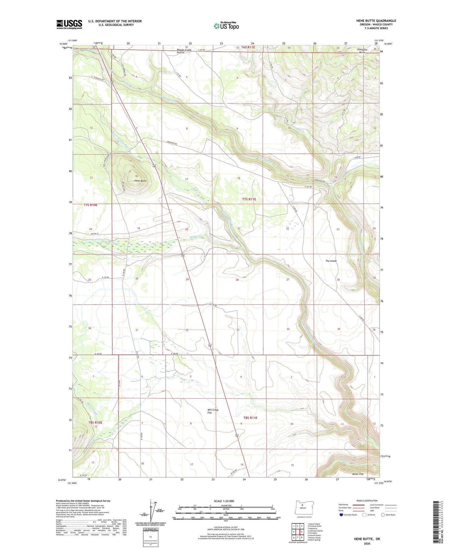
2020 topographic map quadrangle Hehe Butte in the state of Oregon. Scale: 1:24000. Based on the newly updated USGS 7.5' US Topo map series, this map is in the following counties: Wasco. The map contains contour data, water features, and other items you are used to seeing on USGS maps, but also has updated roads and other features. This is the next generation of topographic maps. Printed on high-quality waterproof paper with UV fade-resistant inks.
Quads adjacent to this one:
West: Sidwalter Buttes
Northwest: Beaver Butte
North: Foreman Point
Northeast: Wapinitia
East: Simnasho
Southeast: Warm Springs
South: Potters Ponds
Southwest: Sawmill Butte
Contains the following named places: Badger Corral, Badger Creek, Beaver Creek Prairie, Butte Creek, Coyote Creek, Hehe Butte, Hehe Mill Rodeo Grounds, Island Windmill, Mill Creek Canal, Mill Creek Flat, Quartz Creek, The Island, Warm Springs Division