MyTopo
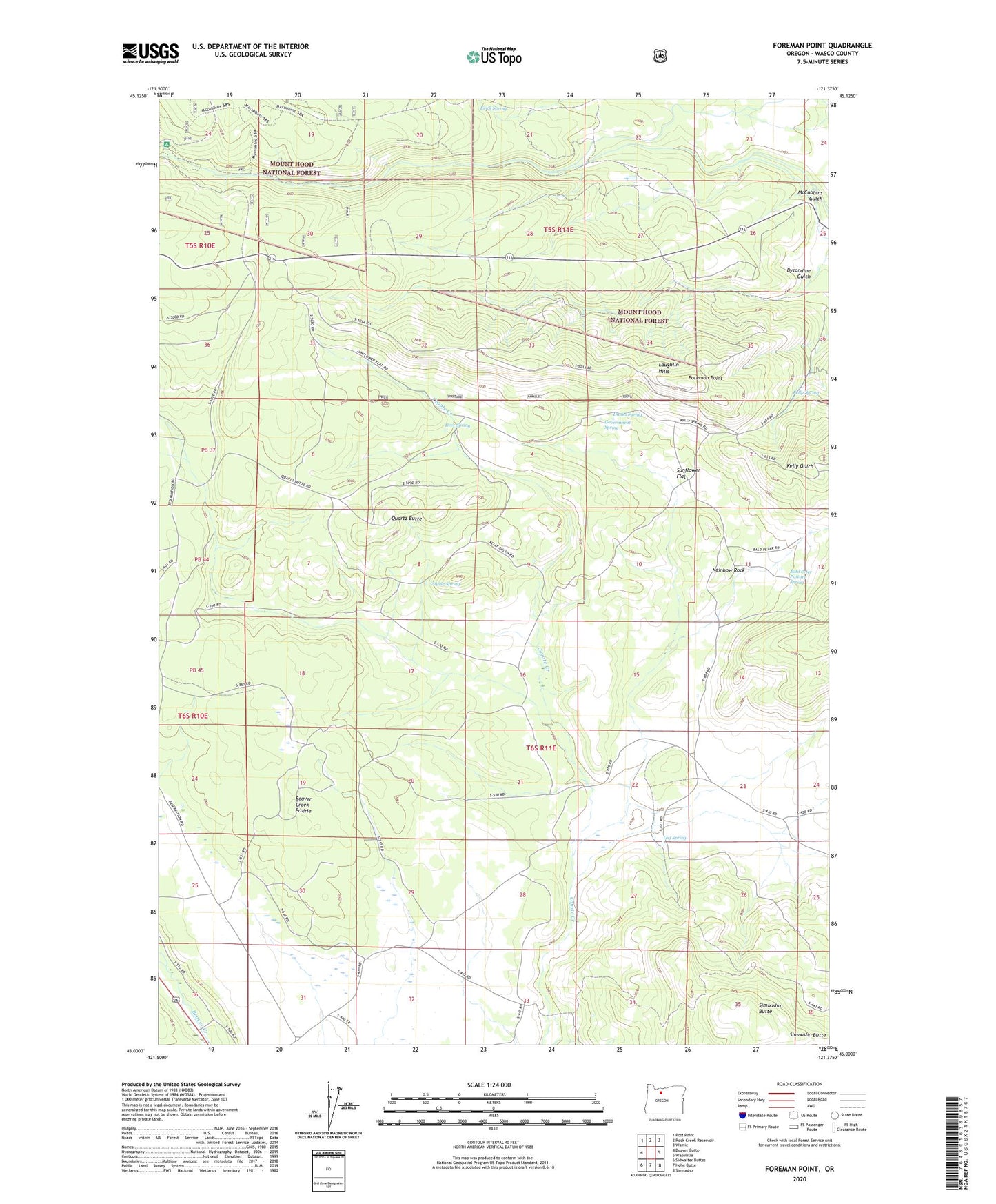
Foreman Point Oregon US Topo Map
Couldn't load pickup availability
Also explore the Foreman Point Forest Service Topo of this same quad for updated USFS data
2024 topographic map quadrangle Foreman Point in the state of Oregon. Scale: 1:24000. Based on the newly updated USGS 7.5' US Topo map series, this map is in the following counties: Wasco. The map contains contour data, water features, and other items you are used to seeing on USGS maps, but also has updated roads and other features. This is the next generation of topographic maps. Printed on high-quality waterproof paper with UV fade-resistant inks.
Quads adjacent to this one:
West: Beaver Butte
Northwest: Post Point
North: Rock Creek Reservoir
Northeast: Wamic
East: Wapinitia
Southeast: Simnasho
South: Hehe Butte
Southwest: Sidwalter Buttes
This map covers the same area as the classic USGS quad with code o45121a4.
Contains the following named places: Bald Peter Pasture Spring, Boundary Log Scaling Station, Coyote Spring, Daniel Spring, Deer Spring, Evick Spring, Foreman Point, Government Spring, Grandview, Kelly Spring, Log Spring, McCubbins Gulch Recreation Site, Quartz Butte, Rainbow Quarry, Rainbow Rock, Rock Creek Recreation Site, Simnasho Butte, Sunflower Flat