MyTopo
Warm Springs Oregon US Topo Map
Couldn't load pickup availability
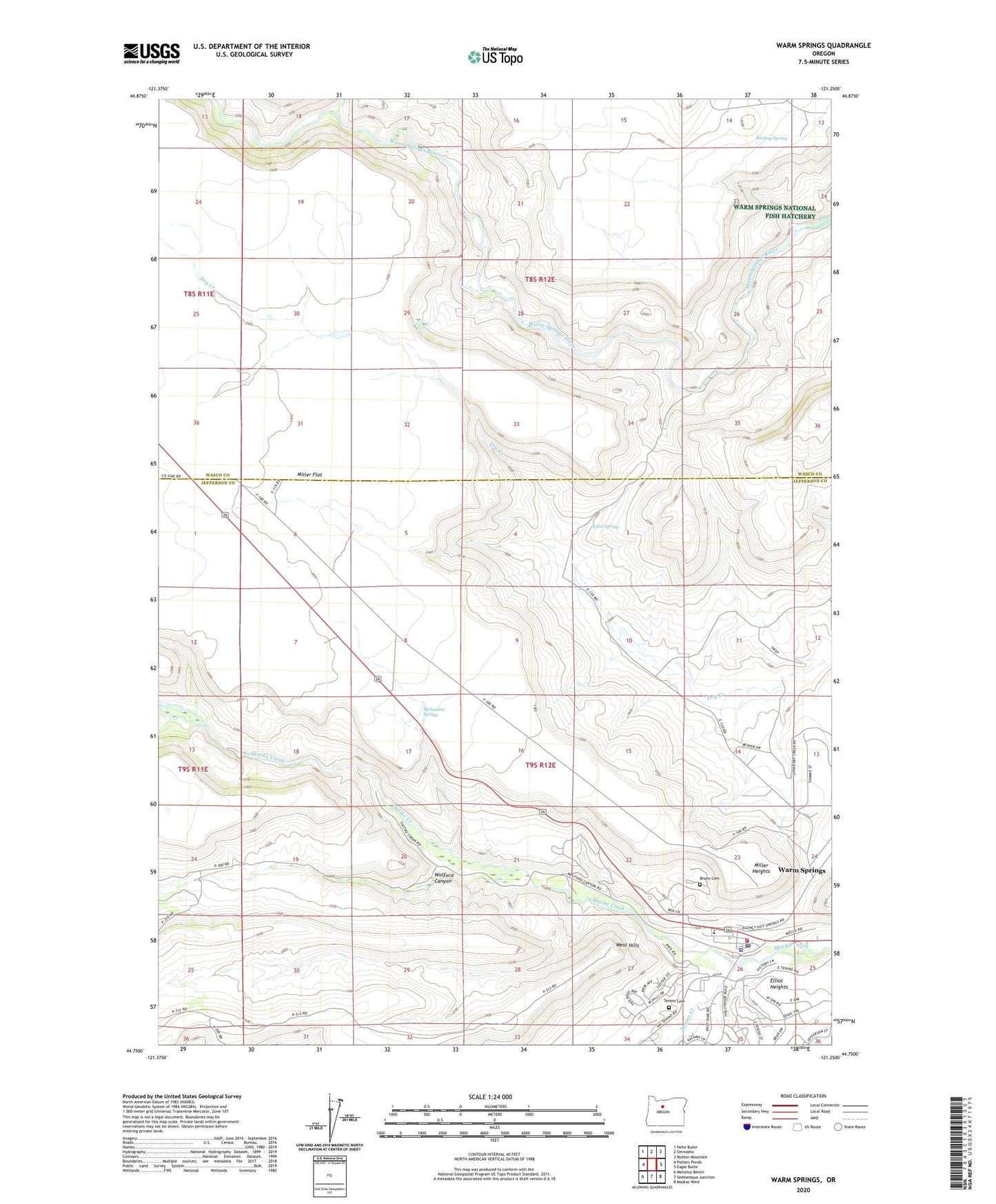
2023 topographic map quadrangle Warm Springs in the state of Oregon. Scale: 1:24000. Based on the newly updated USGS 7.5' US Topo map series, this map is in the following counties: Jefferson, Wasco. The map contains contour data, water features, and other items you are used to seeing on USGS maps, but also has updated roads and other features. This is the next generation of topographic maps. Printed on high-quality waterproof paper with UV fade-resistant inks.
Quads adjacent to this one:
West: Potters Ponds
Northwest: Hehe Butte
North: Simnasho
Northeast: Mutton Mountain
East: Eagle Butte
Southeast: Madras West
South: Seekseequa Junction
Southwest: Metolius Bench
This map covers the same area as the classic USGS quad with code o44121g3.
Contains the following named places: Beaver Creek, Bruno Cemetery, Confederated Tribes of Warm Springs Wastewater Treatment Plant, Elliot Heights, Kuckup Spring, Miller Heights, Symentire Spring, Tenino Cemetery, Tenino Creek, The Museum at Warm Springs, Tohet Spring, Warm Springs, Warm Springs Agency Office, Warm Springs Census Designated Place, Warm Springs Elementary School, Warm Springs Fire and Safety, Warm Springs Library, Warm Springs Post Office, Warm Springs Tribal Police Department, West Hills, Wolford Canyon, ZIP Code: 97761