MyTopo
Horse Sign Butte Oregon US Topo Map
Couldn't load pickup availability
Also explore the Horse Sign Butte Forest Service Topo of this same quad for updated USFS data
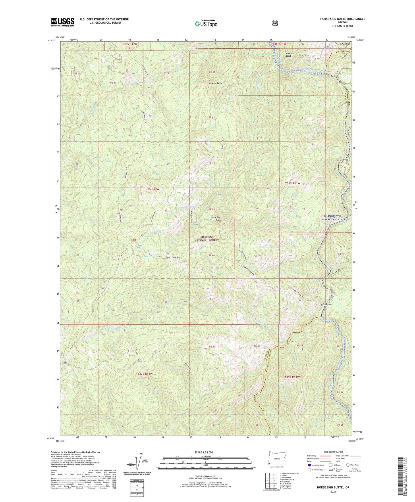
2023 topographic map quadrangle Horse Sign Butte in the state of Oregon. Scale: 1:24000. Based on the newly updated USGS 7.5' US Topo map series, this map is in the following counties: Curry, Josephine. The map contains contour data, water features, and other items you are used to seeing on USGS maps, but also has updated roads and other features. This is the next generation of topographic maps. Printed on high-quality waterproof paper with UV fade-resistant inks.
Quads adjacent to this one:
West: Quosatana Butte
Northwest: Soldier Camp Mountain
North: Agness
Northeast: Brandy Peak
East: Silver Peak
Southeast: Tincup Peak
South: Big Craggies
Southwest: Collier Butte
This map covers the same area as the classic USGS quad with code o42124d1.
Contains the following named places: Black Rock Creek, Bluff Creek, Brandon Camp, Burt Camp, Buzzards Roost, Collier Bar, Conners Place, Forest Creek, Fry Place, Game Lake, Game Lake Lookout, Game Lake Recreation Site, Horse Sign Butte, Horse Sign Creek, Horse Sign Creek Rapids, Hurt Cabin, Indian Flat, Indigo Creek, Lawson Butte, North Fork Collier Creek, Pine Flat Creek, Silver Creek, Sizeable Stream, Sourdough Camp, South Fork Collier Creek