MyTopo
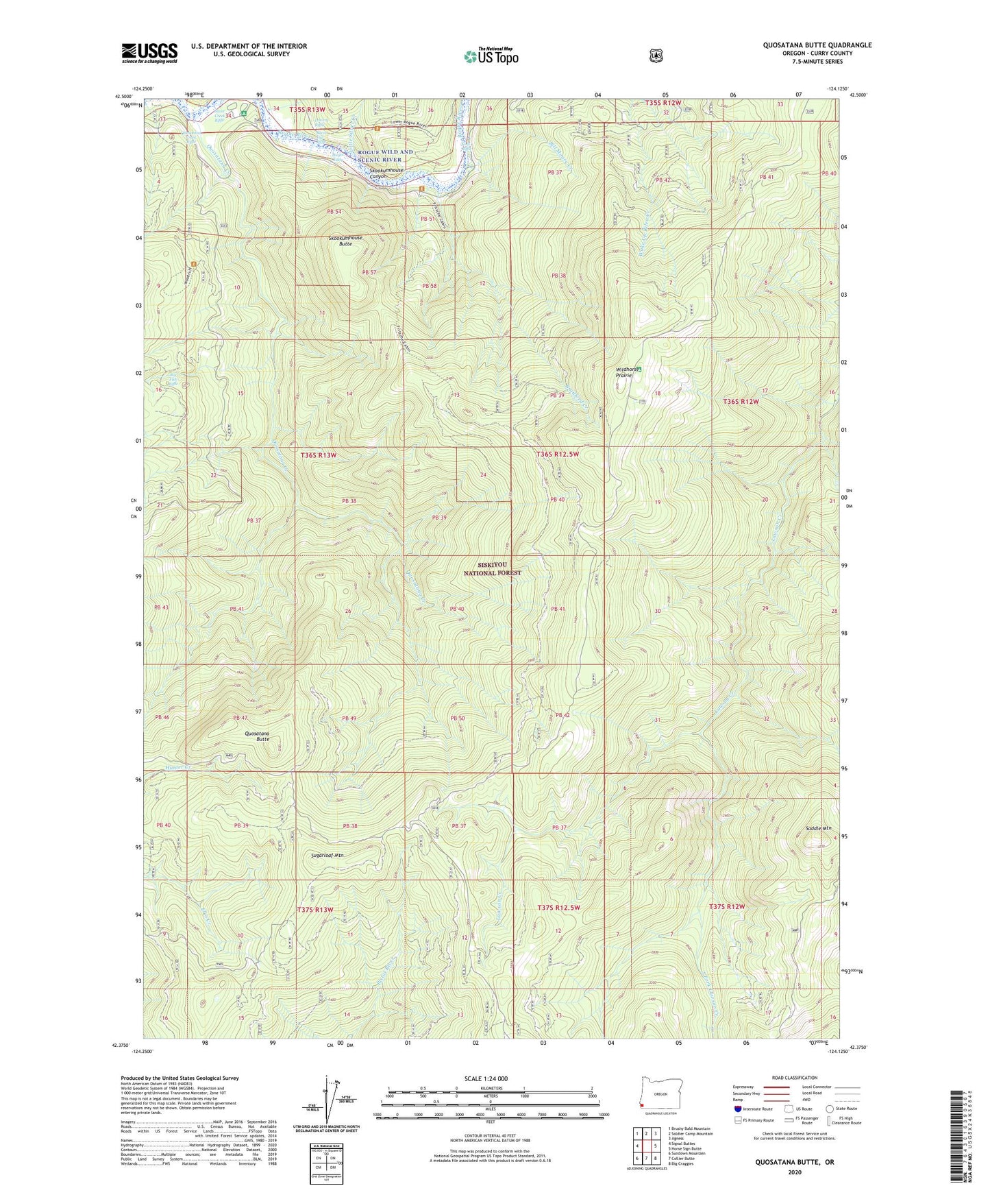
Quosatana Butte Oregon US Topo Map
Couldn't load pickup availability
Also explore the Quosatana Butte Forest Service Topo of this same quad for updated USFS data
2024 topographic map quadrangle Quosatana Butte in the state of Oregon. Scale: 1:24000. Based on the newly updated USGS 7.5' US Topo map series, this map is in the following counties: Curry. The map contains contour data, water features, and other items you are used to seeing on USGS maps, but also has updated roads and other features. This is the next generation of topographic maps. Printed on high-quality waterproof paper with UV fade-resistant inks.
Quads adjacent to this one:
West: Signal Buttes
Northwest: Brushy Bald Mountain
North: Soldier Camp Mountain
Northeast: Agness
East: Horse Sign Butte
Southeast: Big Craggies
South: Collier Butte
Southwest: Sundown Mountain
This map covers the same area as the classic USGS quad with code o42124d2.
Contains the following named places: Bacon Flat Riffle, Big Fish Riffle, Bill Moore Creek, Bowman Ranch, Bradford Creek, Coal Riffle, Curry County, Elko Camp Recreation Site, Fritsche Cabin, Fry Landing, Hayes Eddy, Little Silver Creek, Lowery Riffle, Quosatana Butte, Quosatana Campground Boat Ramp, Quosatana Creek, Quosatana Creek Riffle, Quosatana Recreation Site, Quosation Post Office, Saddle Mountain, Skookumhouse Butte, Skookumhouse Canyon, South Fork Lawson Creek, Sugarloaf Mountain, Wildhorse Lookout, Wildhorse Prairie, Wildhorse Recreation Site, Wilson Cabin