
MyTopo
Imnaha Creek Oregon US Topo Map
Couldn't load pickup availability
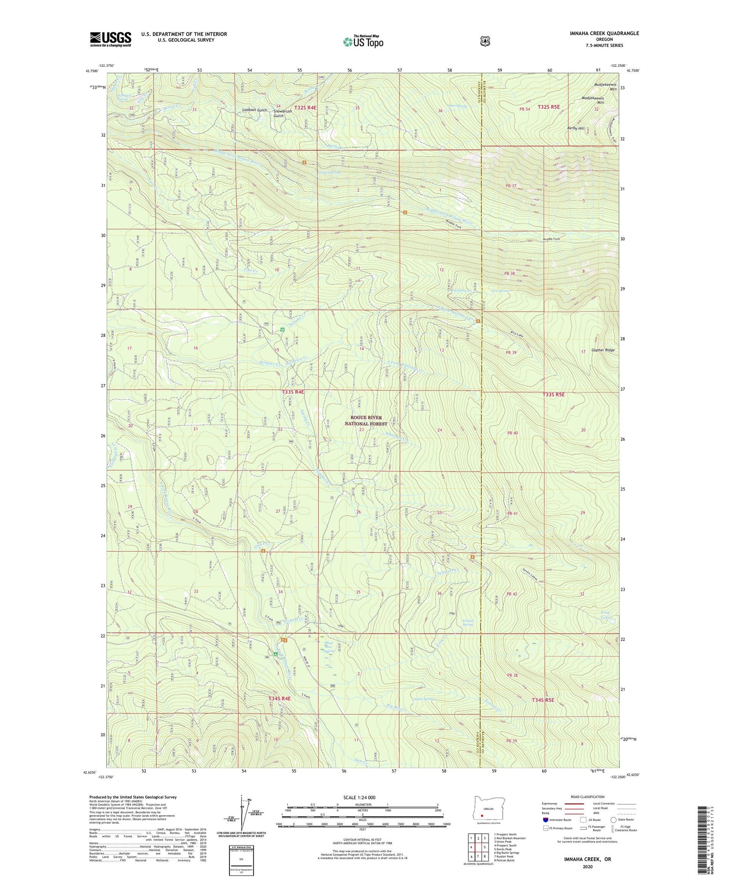
2020 topographic map quadrangle Imnaha Creek in the state of Oregon. Scale: 1:24000. Based on the newly updated USGS 7.5' US Topo map series, this map is in the following counties: Jackson, Klamath. The map contains contour data, water features, and other items you are used to seeing on USGS maps, but also has updated roads and other features. This is the next generation of topographic maps. Printed on high-quality waterproof paper with UV fade-resistant inks.
Quads adjacent to this one:
West: Prospect South
Northwest: Prospect North
North: Red Blanket Mountain
Northeast: Union Peak
East: Devils Peak
Southeast: Pelican Butte
South: Rustler Peak
Southwest: Big Butte Springs
Contains the following named places: Aspen Spring, Bessie Rock Trail, Big Ben Campground, Big Ben Creek, Black Bear Swamp, Fall Creek, Fantail Creek, Fantail Spring, Fire Creek, Fire Spring, Foot Creek, Frey Creek, Frog Lake, Geyser Spring, Green Creek, Halifax Creek, Hemlock Lake Trail, Hemlock Spring, Imnaha Guard Station, Imnaha Recreation Site, Kerby Creek, Kerby Hill, King Spruce Camp, King Spruce Trail, Lodgepole Creek, Lookout Gulch, Mudjekeewis Mountain, Mudjekeewis Trail, Nichols Camp, Nichols Creek, North Fork Wallowa Creek, Otter Spring, Rogue River National Forest, Sam Creek, Seven Lakes Trail, Snowbrush Gulch, South Fork Recreation Site, South Fork Wallowa Creek, Spring Creek, Sumpter Creek, Sumpter Creek Camp, Wallowa Creek, Whitman Creek


