MyTopo
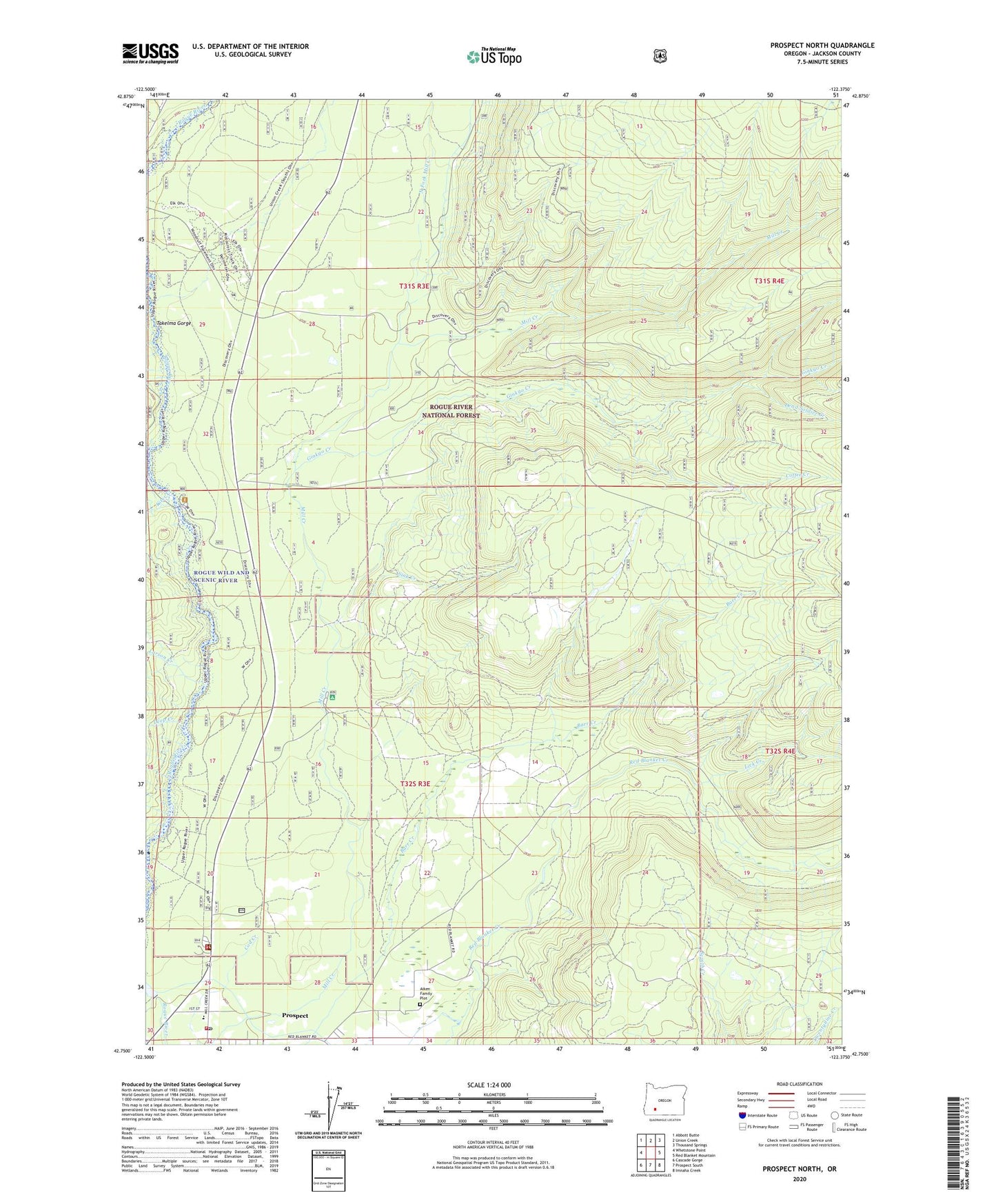
Prospect North Oregon US Topo Map
Couldn't load pickup availability
Also explore the Prospect North Forest Service Topo of this same quad for updated USFS data
2023 topographic map quadrangle Prospect North in the state of Oregon. Scale: 1:24000. Based on the newly updated USGS 7.5' US Topo map series, this map is in the following counties: Jackson. The map contains contour data, water features, and other items you are used to seeing on USGS maps, but also has updated roads and other features. This is the next generation of topographic maps. Printed on high-quality waterproof paper with UV fade-resistant inks.
Quads adjacent to this one:
West: Whetstone Point
Northwest: Abbott Butte
North: Union Creek
Northeast: Thousand Springs
East: Red Blanket Mountain
Southeast: Imnaha Creek
South: Prospect South
Southwest: Cascade Gorge
This map covers the same area as the classic USGS quad with code o42122g4.
Contains the following named places: Aiken Family Plot, Coffee Creek, Dead Soldier Creek, Deep Creek, Ginkgo Creek, Ginkgo Trail, Graham Creek, High Cascades Ranger District - Prospect Office, Kiter Creek, Larson Creek, Lick Creek, Lund Creek, Mammoth Pines, Mammoth Pines Picnic Area, Mill Creek Recreation Site, Needle Creek, North Fork Diversion Dam, North Fork Diversion Reservoir, North Fork Mill Creek, Prospect, Prospect Branch Library, Prospect Census Designated Place, Prospect Fire Department, Prospect Post Office, Prospect Sanitary Landfill, Prospect School, Red Blanket Reservoir, River Bridge Recreation Site, Sink Creek, Skeeters Camp, Takelma Gorge, Union Rogue Church Camp, United States Forest Service Prospect Ranger District, ZIP Code: 97536