
MyTopo
Indian Butte Oregon US Topo Map
Couldn't load pickup availability
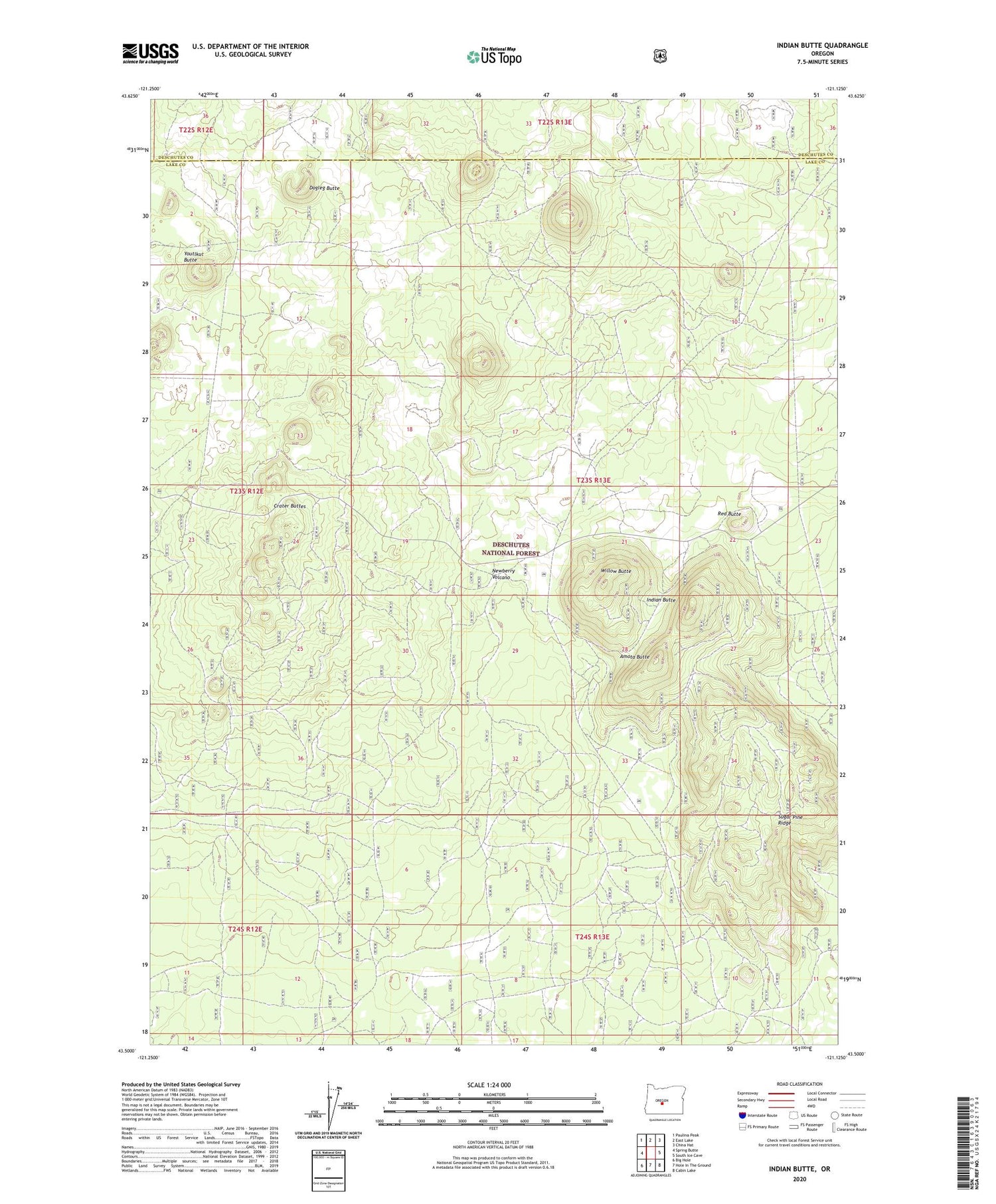
2020 topographic map quadrangle Indian Butte in the state of Oregon. Scale: 1:24000. Based on the newly updated USGS 7.5' US Topo map series, this map is in the following counties: Lake, Deschutes. The map contains contour data, water features, and other items you are used to seeing on USGS maps, but also has updated roads and other features. This is the next generation of topographic maps. Printed on high-quality waterproof paper with UV fade-resistant inks.
Quads adjacent to this one:
West: Spring Butte
Northwest: Paulina Peak
North: East Lake
Northeast: China Hat
East: South Ice Cave
Southeast: Cabin Lake
South: Hole In The Ground
Southwest: Big Hole
Contains the following named places: Amota Butte, Crater Buttes, Dogleg Butte, Hokisam Cones, Indian Butte, Jack Butte, Ooskan Butte, Red Butte, Rim Butte, Sugar Pine Ridge, Tom Butte, Triangle Buttes, Willow Butte, Youtlkut Butte


