MyTopo
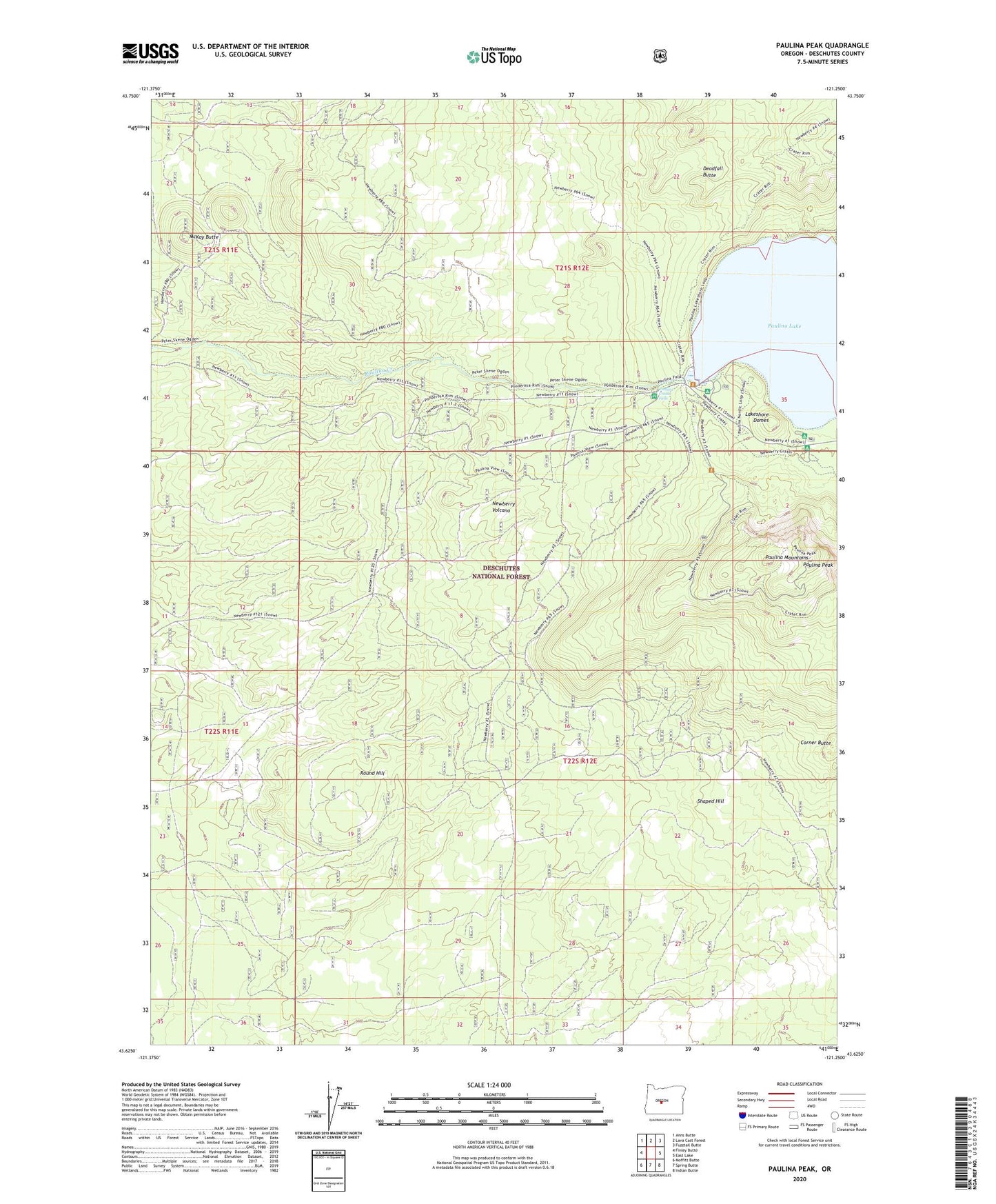
Paulina Peak Oregon US Topo Map
Couldn't load pickup availability
Also explore the Paulina Peak Forest Service Topo of this same quad for updated USFS data
2024 topographic map quadrangle Paulina Peak in the state of Oregon. Scale: 1:24000. Based on the newly updated USGS 7.5' US Topo map series, this map is in the following counties: Deschutes. The map contains contour data, water features, and other items you are used to seeing on USGS maps, but also has updated roads and other features. This is the next generation of topographic maps. Printed on high-quality waterproof paper with UV fade-resistant inks.
Quads adjacent to this one:
West: Finley Butte
Northwest: Anns Butte
North: Lava Cast Forest
Northeast: Fuzztail Butte
East: East Lake
Southeast: Indian Butte
South: Spring Butte
Southwest: Moffitt Butte
This map covers the same area as the classic USGS quad with code o43121f3.
Contains the following named places: Chief Paulina Horse Camp, Chief Paulina Trailhead, Corner Butte, Deadfall Butte, Dukdukwasam Butte, Huna Butte, Lakeshore Domes, McKay Butte, Newberry Group Camp, North Cove Campground, Paulina Creek Falls, Paulina Falls Recreation Site, Paulina Lake, Paulina Lake Campground Boat Ramp, Paulina Lake Lodge, Paulina Lake Lodge Boat Ramp, Paulina Lake Recreation Site, Paulina Lake Visitor Center, Paulina Mountains, Paulina Peak, Paulina Peak Trail, Paulina Peak Trailhead, Round Hill, Shaped Hill, Taktakli Butte, Ten Mile Sno-Park