MyTopo
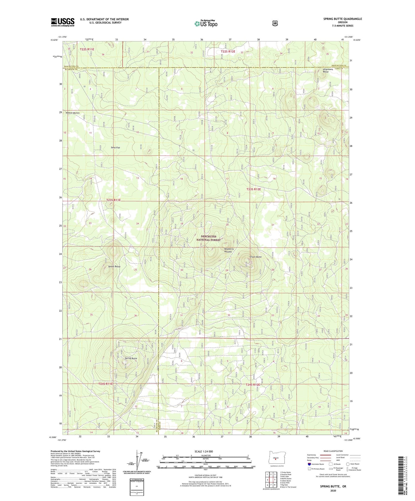
Spring Butte Oregon US Topo Map
Couldn't load pickup availability
Also explore the Spring Butte Forest Service Topo of this same quad for updated USFS data
2023 topographic map quadrangle Spring Butte in the state of Oregon. Scale: 1:24000. Based on the newly updated USGS 7.5' US Topo map series, this map is in the following counties: Lake, Klamath, Deschutes. The map contains contour data, water features, and other items you are used to seeing on USGS maps, but also has updated roads and other features. This is the next generation of topographic maps. Printed on high-quality waterproof paper with UV fade-resistant inks.
Quads adjacent to this one:
West: Moffitt Butte
Northwest: Finley Butte
North: Paulina Peak
Northeast: East Lake
East: Indian Butte
Southeast: Hole In The Ground
South: Big Hole
Southwest: Grass Well
This map covers the same area as the classic USGS quad with code o43121e3.
Contains the following named places: Alignment Butte, Green Butte, Ipsoot Butte, Jones Well, Jones Well Guard Station, Sand Flat, Skoksam Hill, Spring Butte, Spring Butte Well, Spring Butte Well Camp, Taba Butte