MyTopo
Jackies Butte Oregon US Topo Map
Couldn't load pickup availability
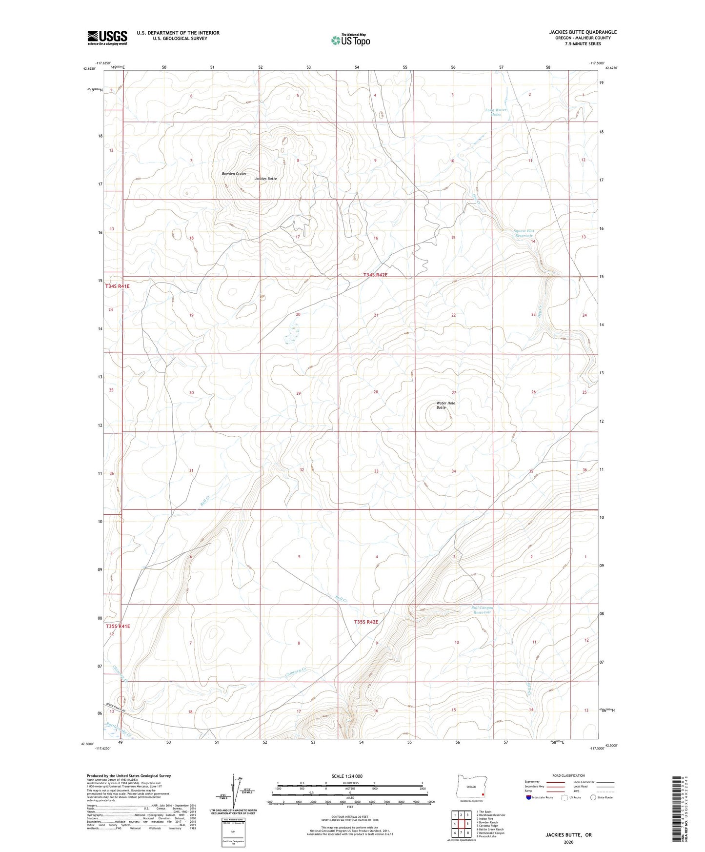
2023 topographic map quadrangle Jackies Butte in the state of Oregon. Scale: 1:24000. Based on the newly updated USGS 7.5' US Topo map series, this map is in the following counties: Malheur. The map contains contour data, water features, and other items you are used to seeing on USGS maps, but also has updated roads and other features. This is the next generation of topographic maps. Printed on high-quality waterproof paper with UV fade-resistant inks.
Quads adjacent to this one:
West: Bowden Ranch
Northwest: The Basin
North: Rockhouse Reservoir
Northeast: Indian Fort
East: Caviatta Ridge
Southeast: Peacock Lake
South: Rattlesnake Canyon
Southwest: Battle Creek Ranch
This map covers the same area as the classic USGS quad with code o42117e5.
Contains the following named places: Beber Ranch, Bowden Crater, Bull Canyon Reservoir, Grafton Well, Jackies Butte, Long Water Holes, Water Hole Butte