MyTopo
Jordan Craters North Oregon US Topo Map
Couldn't load pickup availability
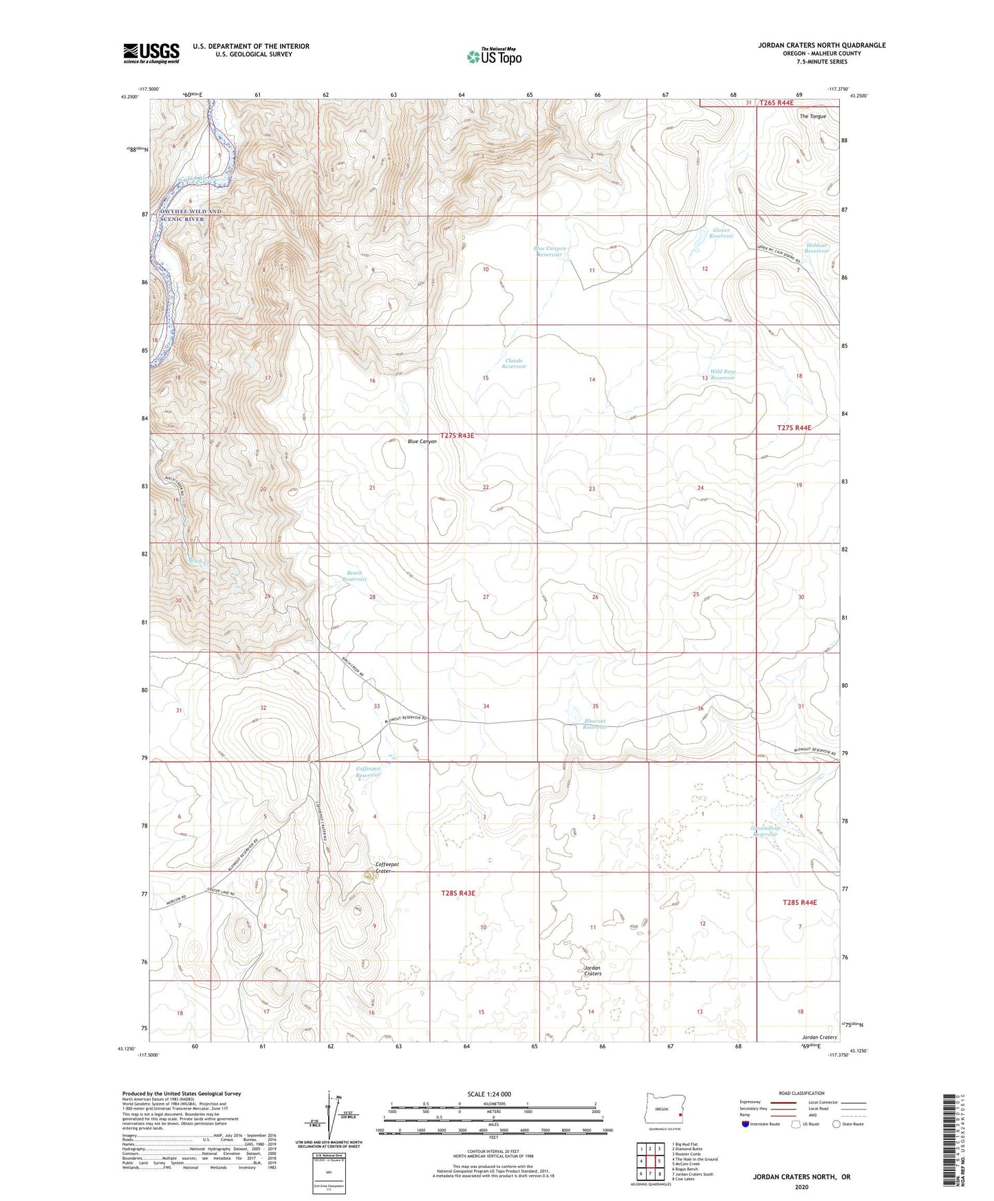
2023 topographic map quadrangle Jordan Craters North in the state of Oregon. Scale: 1:24000. Based on the newly updated USGS 7.5' US Topo map series, this map is in the following counties: Malheur. The map contains contour data, water features, and other items you are used to seeing on USGS maps, but also has updated roads and other features. This is the next generation of topographic maps. Printed on high-quality waterproof paper with UV fade-resistant inks.
Quads adjacent to this one:
West: The Hole in the Ground
Northwest: Big Mud Flat
North: Diamond Butte
Northeast: Rooster Comb
East: McCain Creek
Southeast: Cow Lakes
South: Jordan Craters South
Southwest: Bogus Bench
This map covers the same area as the classic USGS quad with code o43117b4.
Contains the following named places: Bench Reservoir, Blowout Reservoir, Blue Canyon Reservoir, Claude Reservoir, Coffeepot Crater, Coffeepot Reservoir, George Ranch, Glover Reservoir, Groundhog Reservoir, Holdout Reservoir, The Pinnacle Ranch Airstrip, Wild Rose Reservoir