MyTopo
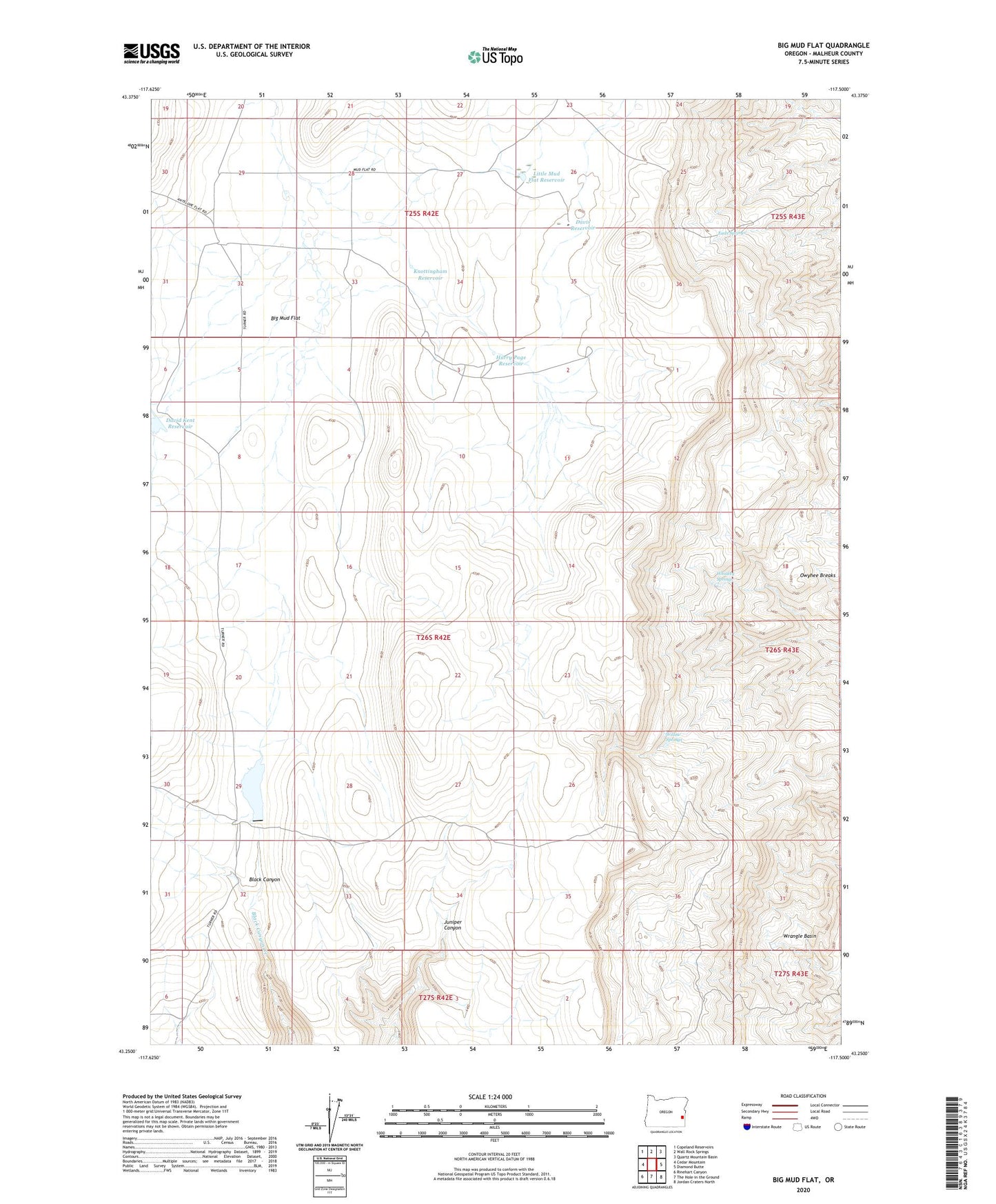
Big Mud Flat Oregon US Topo Map
Couldn't load pickup availability
2023 topographic map quadrangle Big Mud Flat in the state of Oregon. Scale: 1:24000. Based on the newly updated USGS 7.5' US Topo map series, this map is in the following counties: Malheur. The map contains contour data, water features, and other items you are used to seeing on USGS maps, but also has updated roads and other features. This is the next generation of topographic maps. Printed on high-quality waterproof paper with UV fade-resistant inks.
Quads adjacent to this one:
West: Cedar Mountain
Northwest: Copeland Reservoirs
North: Wall Rock Springs
Northeast: Quartz Mountain Basin
East: Diamond Butte
Southeast: Jordan Craters North
South: The Hole in the Ground
Southwest: Rinehart Canyon
This map covers the same area as the classic USGS quad with code o43117c5.
Contains the following named places: Ben Odell Reservoir, Big Mud Flat, Black Canyon Creek Dam, David Kent Dam, David Kent Reservoir, Davis Reservoir, Eads Hill Trail, Eads Springs, Harry Page Reservoir, Knottingham Reservoir, Little Mud Flat Reservoir, Mud Flat Ranch, Owyhee Breaks, Whiskey Springs, Willow Springs, Wrangle Basin