MyTopo
Jubilee Lake Oregon US Topo Map
Couldn't load pickup availability
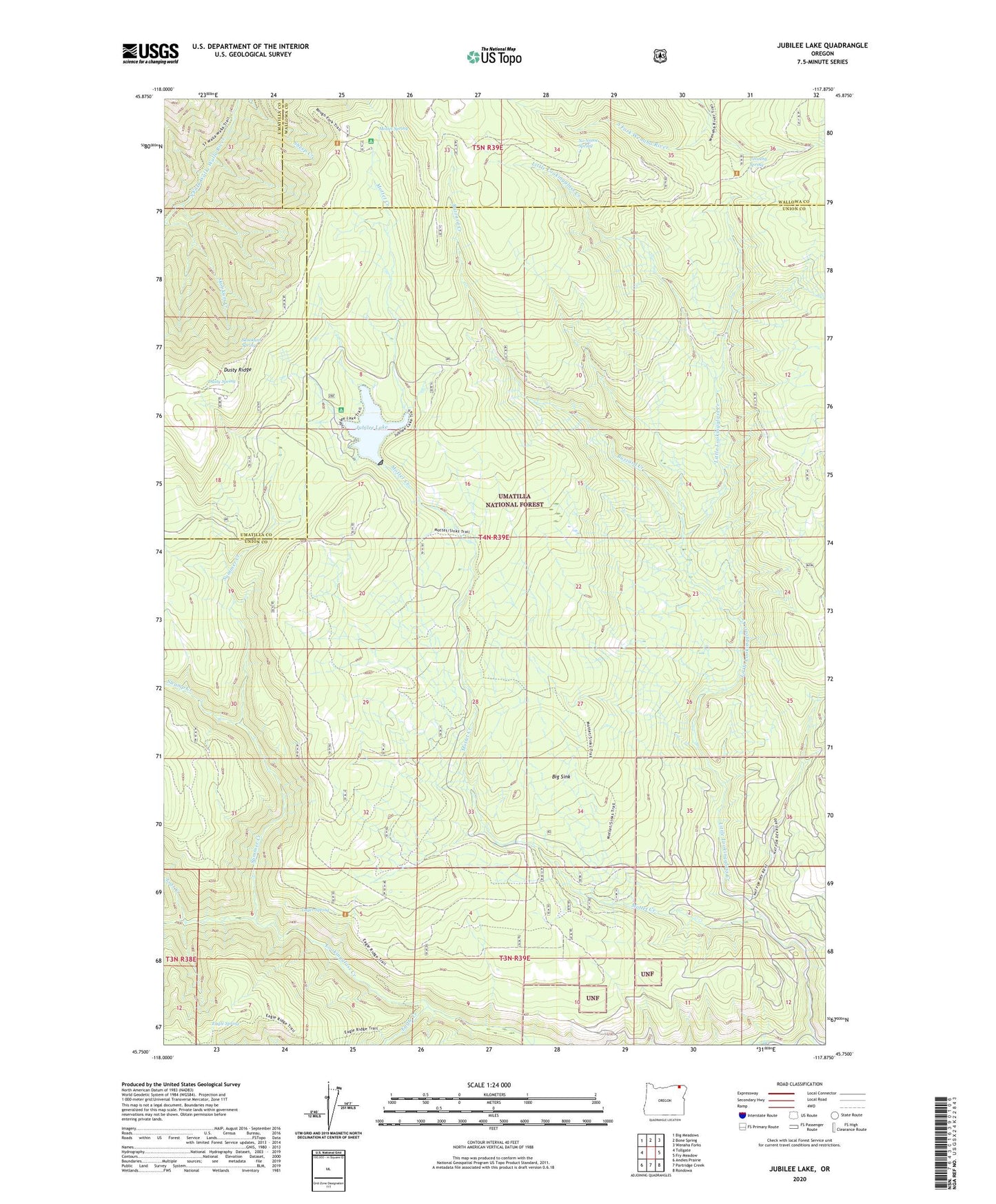
2020 topographic map quadrangle Jubilee Lake in the state of Oregon. Scale: 1:24000. Based on the newly updated USGS 7.5' US Topo map series, this map is in the following counties: Union, Umatilla, Wallowa. The map contains contour data, water features, and other items you are used to seeing on USGS maps, but also has updated roads and other features. This is the next generation of topographic maps. Printed on high-quality waterproof paper with UV fade-resistant inks.
Quads adjacent to this one:
West: Tollgate
Northwest: Big Meadows
North: Bone Spring
Northeast: Wenaha Forks
East: Fry Meadow
Southeast: Rondowa
South: Partridge Creek
Southwest: Andies Prairie
Contains the following named places: Big Sink, Buzzard Creek, Dusty Ridge, Dusty Spring, Dusty Spring Forest Camp, Eagle Creek, Eagle Spring, Jubilee Lake, Jubilee Lake Campground Boat Ramp, Jubilee Lake Recreation Site, Jubilee Meadows Dam, Little Lookingglass Creek, Lost Creek, Luger Spring, Mottet Creek, Mottet Recreation Site, Mottet Spring, No Name Spring, Skookum Creek, Skookum Spring, Summer Creek, Swamp Creek, Timothy Guard Station, Timothy Spring, Timothy Spring Campground