MyTopo
Junction City Oregon US Topo Map
Couldn't load pickup availability
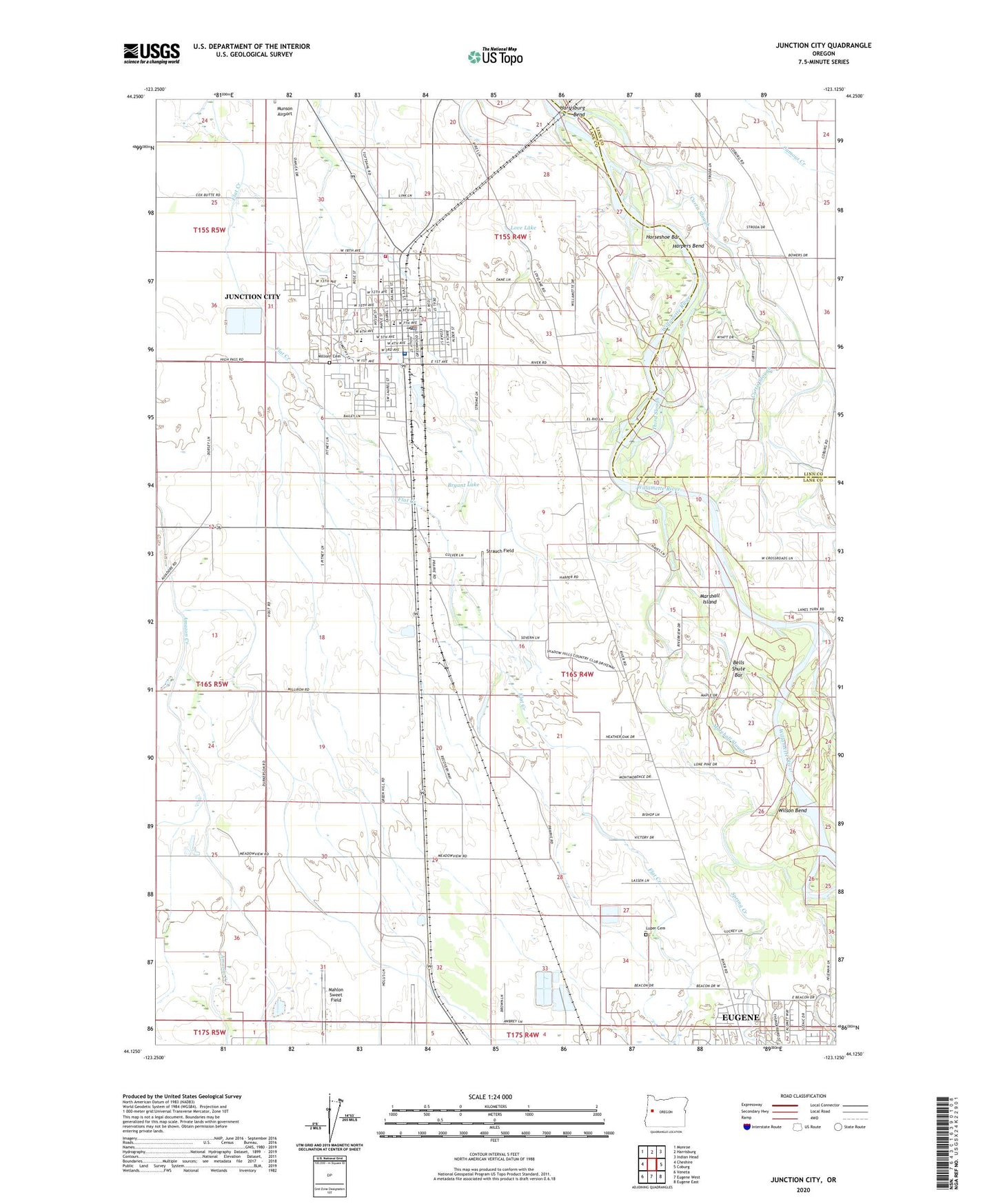
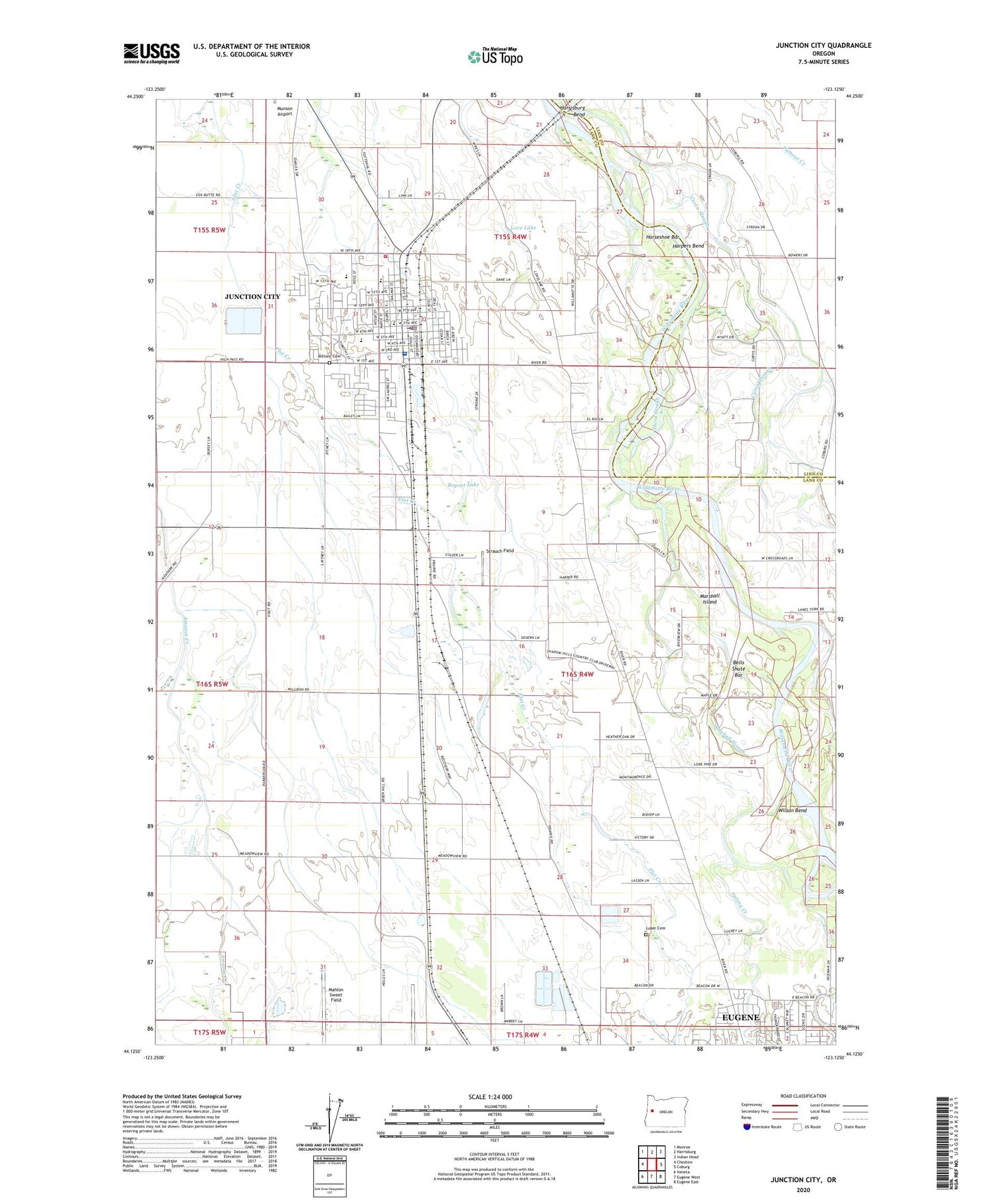
2020 topographic map quadrangle Junction City in the state of Oregon. Scale: 1:24000. Based on the newly updated USGS 7.5' US Topo map series, this map is in the following counties: Lane, Linn. The map contains contour data, water features, and other items you are used to seeing on USGS maps, but also has updated roads and other features. This is the next generation of topographic maps. Printed on high-quality waterproof paper with UV fade-resistant inks.
Quads adjacent to this one:
West: Cheshire
Northwest: Monroe
North: Harrisburg
Northeast: Indian Head
East: Coburg
Southeast: Eugene East
South: Eugene West
Southwest: Veneta
Contains the following named places: Awbrey, Awbrey City Park, Ayres Airstrip, Bailey Park, Bells Shute Bar, Bergstrom Park, Brown's Boat Skid, Browns Landing State Park, Bryant Lake, Christensen Landing Park, Christensen's Landing Boat Ramp, Christ's Center School, City of Junction City, Country Plaza Golf Course, Crow Creek, Crown Zellerbach, Curtis Slough, Day Memorial Park, Department of Motor Vehicles Junction City, Eugene Blue Star Safety Rest Area, Faith Lutheran Church, Grand Prairie Post Office, Harpers Bend, Harrisburg Bend, Horseshoe Bar, Junction City, Junction City Hall, Junction City High School, Junction City Historical Society Museum, Junction City Municipal Court, Junction City Police Department, Junction City Post Office, Junction City Public Library, Junction City Public Works Shop, Junction City Remilling, Junction City Rural Fire Protection District Station 1, Junction City Substation, Junction City Wastewater Treatment Facility, Junction City Water Treatment, Lane Transit District Park and Ride, Laurel Elementary School, Laurel Park, Love Lake, Luper, Luper Cemetery, Marshall Island, Marshall Island Access Boat Ramp, Marshall Slough, Meadow View, Milliorn Cemetery, Milorn, Oaklea Middle School, Pondexter Creek, Riverview, Riverview School, Shadow Hills Country Club, Spring Creek, Strauch Field, Swain, Team Track, Third Slough, Tri County Worship Center, Valley Plywood Company Spur, Washburne Park, Western Farmers Spur, Wilson Bend, Wyatt Elementary School