MyTopo
Cheshire Oregon US Topo Map
Couldn't load pickup availability
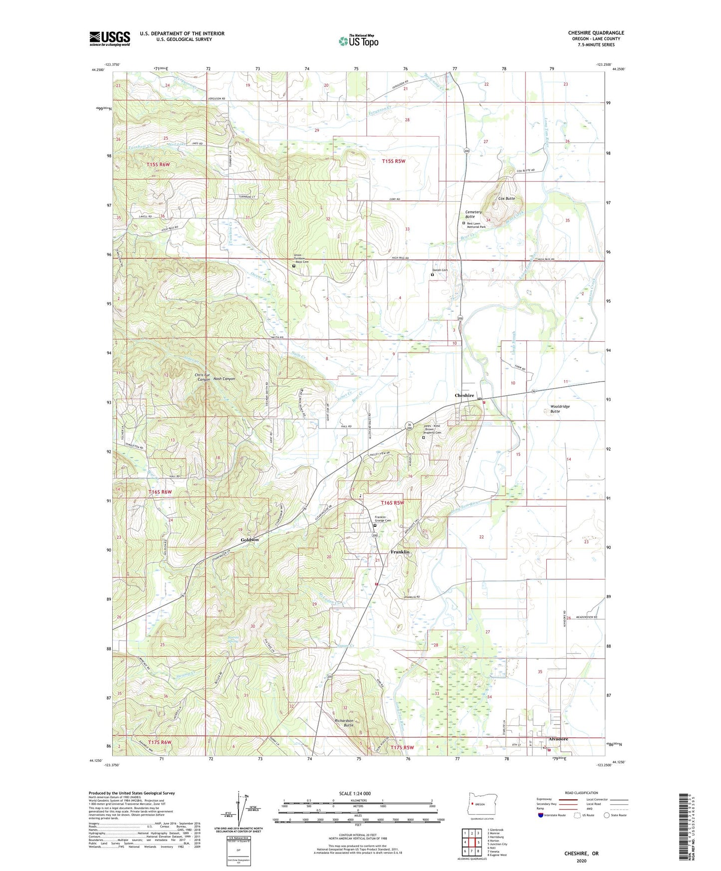
2024 topographic map quadrangle Cheshire in the state of Oregon. Scale: 1:24000. Based on the newly updated USGS 7.5' US Topo map series, this map is in the following counties: Lane. The map contains contour data, water features, and other items you are used to seeing on USGS maps, but also has updated roads and other features. This is the next generation of topographic maps. Printed on high-quality waterproof paper with UV fade-resistant inks.
Quads adjacent to this one:
West: Horton
Northwest: Glenbrook
North: Monroe
Northeast: Harrisburg
East: Junction City
Southeast: Eugene West
South: Veneta
Southwest: Noti
This map covers the same area as the classic USGS quad with code o44123b3.
Contains the following named places: Adkins, Alvadore, Alvadore Community Library, Alvadore Post Office, Amazon Creek, Barrett Spring, Bear Creek, Browning Creek, Cemetery Butte, Cheshire, Cheshire Census Designated Place, Cheshire Post Office, Chris Fur Canyon, Cox Butte, Danish Cemetery, Drews Airstrip, Franklin, Franklin Grange Cemetery, Franklin Post Office, Georgetown, Goldson, Goldson Post Office, Jones - Kime - Brown Property Cemetery, Jones Creek, Junction City Division, Junction City Rural Fire Protection District Station 2, Lane Rural Fire and Rescue Station 52, Lane Rural Fire and Rescue Station 53, Liberty School, Lingo Slough, McLaden Creek, Nails Creek, Nash Canyon, Neil Lake, Owens Creek, Piney Post Office, Rest Lawn Memorial Park, Richardson Butte, Squaw Creek, Territorial Elementary School, Turnbow Creek, Union - Turnbow - Mays Cemetery, Wooldridge Butte, ZIP Code: 97448