MyTopo
Coburg Oregon US Topo Map
Couldn't load pickup availability
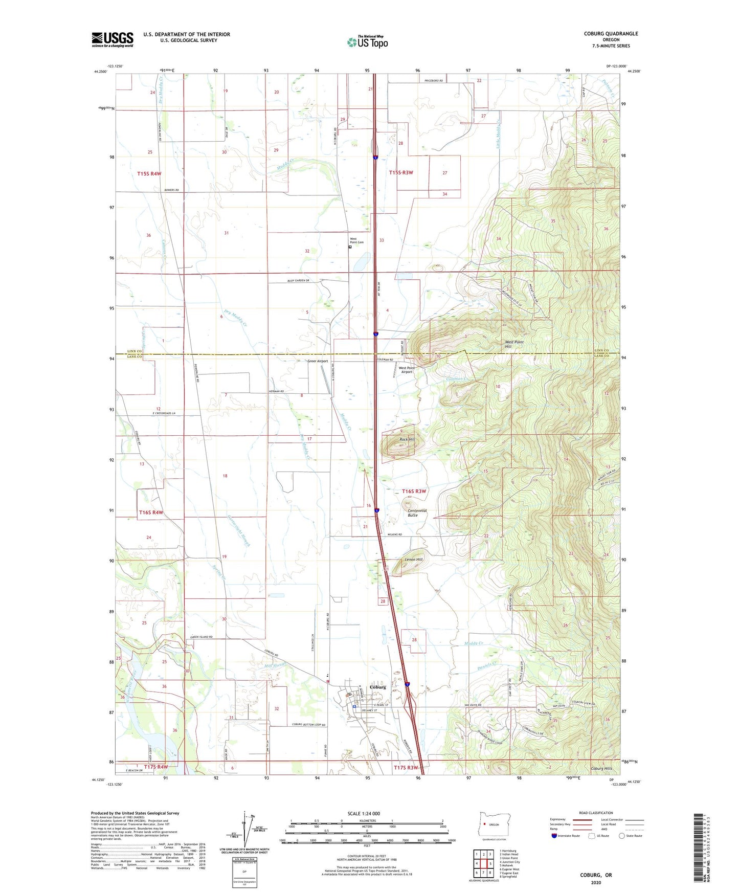
2023 topographic map quadrangle Coburg in the state of Oregon. Scale: 1:24000. Based on the newly updated USGS 7.5' US Topo map series, this map is in the following counties: Lane, Linn. The map contains contour data, water features, and other items you are used to seeing on USGS maps, but also has updated roads and other features. This is the next generation of topographic maps. Printed on high-quality waterproof paper with UV fade-resistant inks.
Quads adjacent to this one:
West: Junction City
Northwest: Harrisburg
North: Indian Head
Northeast: Union Point
East: Mohawk
Southeast: Springfield
South: Eugene East
Southwest: Eugene West
This map covers the same area as the classic USGS quad with code o44123b1.
Contains the following named places: Anderson, Bowers, Briggs Airport, Canterbury Creek, Cartwright Slough, Centennial Butte, City of Coburg, Coburg, Coburg City Hall, Coburg Division, Coburg Elementary School, Coburg Municipal Court, Coburg Police Department, Coburg Post Office, Coburg Public Works Shop, Coburg Rural Fire Protection District, Coburg Water Treatment Plant, Coleman Creek, Daniels Creek, Dry Muddy Creek, Greer Airport, Hileman Landing Boat Ramp, Hileman Landing County Park, Lenon Hill, McKenzie River, Mill Slough, Norma Pfeiffer Park, Oak Grove Safety Rest Area, Palos Post Office, Pine Post Office, Priceboro, Rock Hill, West Point Airport, West Point Cemetery, West Point Hill, Wilkins, ZIP Code: 97408