MyTopo
Keating NW Oregon US Topo Map
Couldn't load pickup availability
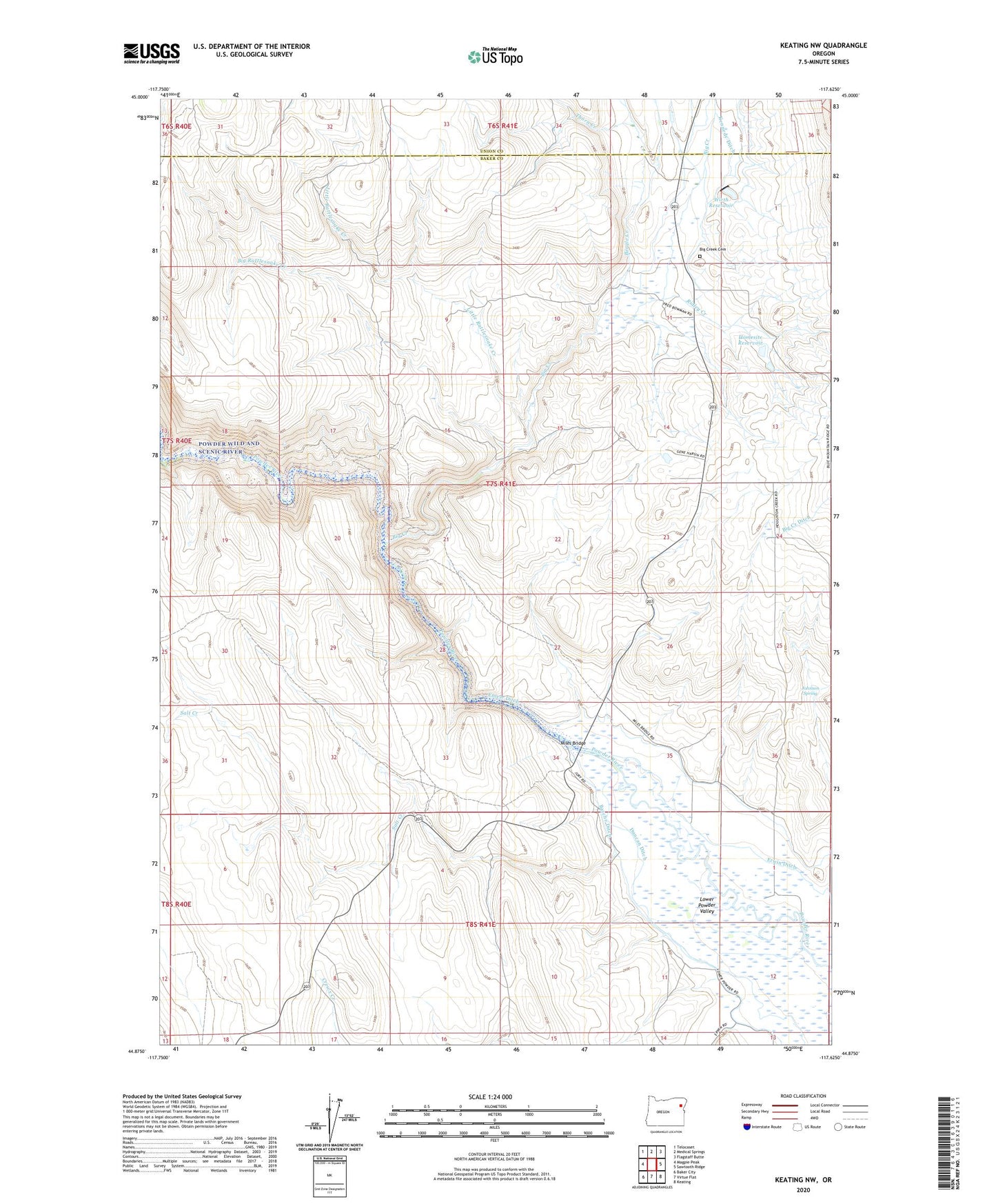
2020 topographic map quadrangle Keating NW in the state of Oregon. Scale: 1:24000. Based on the newly updated USGS 7.5' US Topo map series, this map is in the following counties: Baker, Union. The map contains contour data, water features, and other items you are used to seeing on USGS maps, but also has updated roads and other features. This is the next generation of topographic maps. Printed on high-quality waterproof paper with UV fade-resistant inks.
Quads adjacent to this one:
West: Magpie Peak
Northwest: Telocaset
North: Medical Springs
Northeast: Flagstaff Butte
East: Sawtooth Ridge
Southeast: Keating
South: Virtue Flat
Southwest: Baker City
Contains the following named places: Basche Ditch, Beagle Creek, Big Creek, Big Creek Cemetery, Big Rattlesnake Creek, Blue Mountain School, Crews Creek, Duncan Ditch, Emele Ditch, Erwin Ditch, Homesite Reservoir, Jamestown, Jamestown Post Office, Johnson Spring, Kennedy Ditch, Little Rattlesnake Creek, Miles, Miles Bridge, Miles Post Office, Powder Wild and Scenic River, Ridley Creek, Salt Creek, Thorn Creek, Wirth Dam, Wirth Reservoir