MyTopo
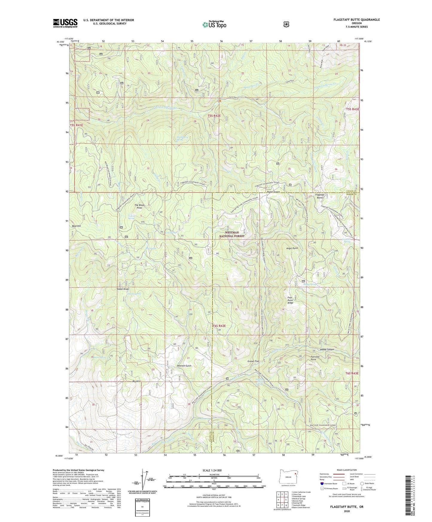
Flagstaff Butte Oregon US Topo Map
Couldn't load pickup availability
Also explore the Flagstaff Butte Forest Service Topo of this same quad for updated USFS data
2023 topographic map quadrangle Flagstaff Butte in the state of Oregon. Scale: 1:24000. Based on the newly updated USGS 7.5' US Topo map series, this map is in the following counties: Union, Baker. The map contains contour data, water features, and other items you are used to seeing on USGS maps, but also has updated roads and other features. This is the next generation of topographic maps. Printed on high-quality waterproof paper with UV fade-resistant inks.
Quads adjacent to this one:
West: Medical Springs
Northwest: Little Catherine Creek
North: China Cap
Northeast: Steamboat Lake
East: Bennet Peak
Southeast: Balm Creek Reservoir
South: Sawtooth Ridge
Southwest: Keating NW
This map covers the same area as the classic USGS quad with code o45117a5.
Contains the following named places: Alder Creek, Angel Point, Argenti Spring, Bazine Spring, Big Hill, Bottle Creek, Burn Creek, Burn Creek Mine, Camp Creek, Cold Spring, Collins Creek, Conundrum Creek, Corral Creek, Fairview Point, Flagstaff Butte, Four Point Ridge, Gobel Draw, Gravel Flat, Happy Canyon, Happy Spring, Huckleberry Spring, Lick Creek, Marlin Spring, Mud Spring, Pawnee Gulch, Pole Creek, Prong Creek, Sand Pass Creek, South Catherine Ditch, Sufferin Smith Spring, Taylor Green, The Black Pines, Trout Creek, Universal Spring, Velvet Creek