MyTopo
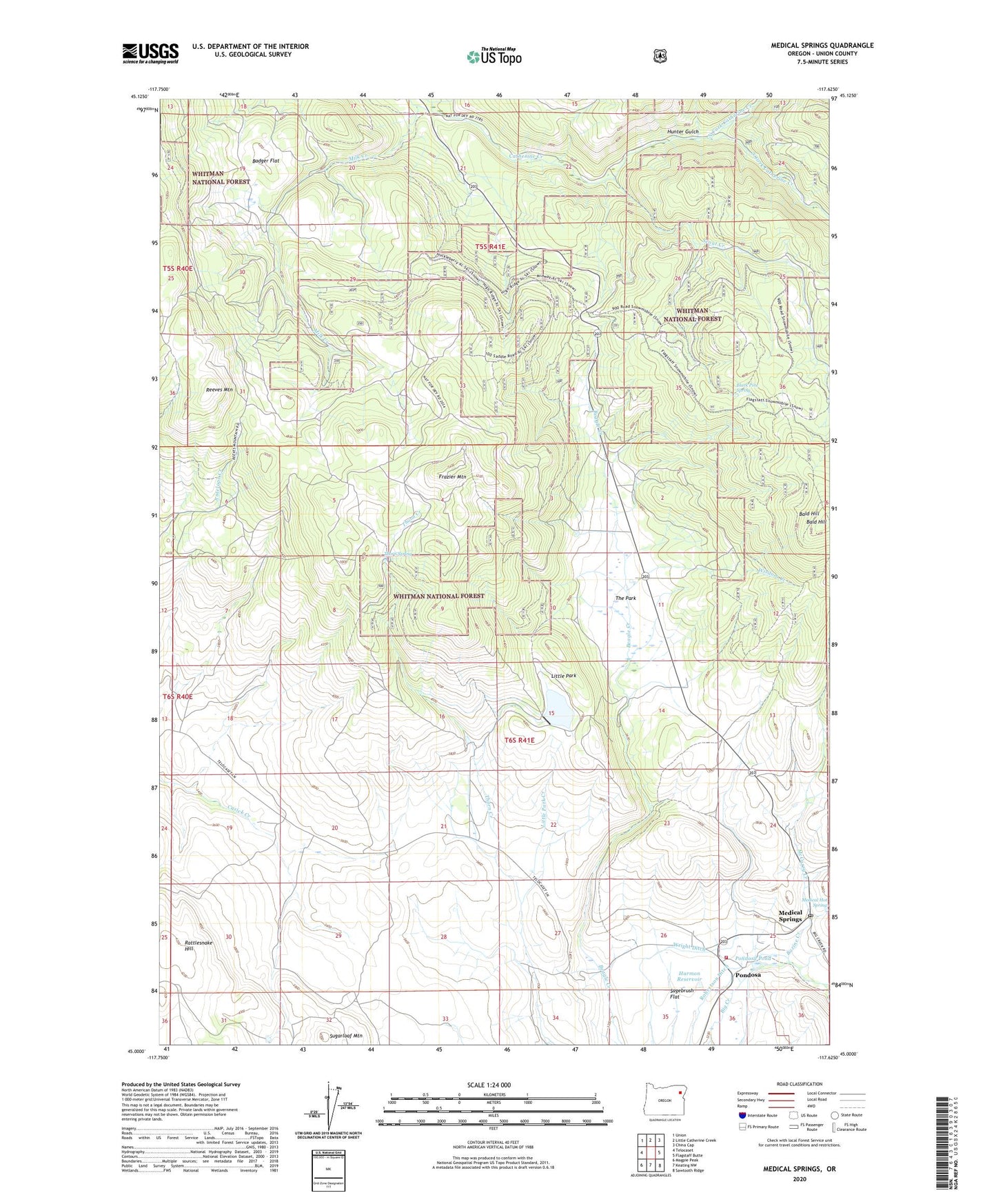
Medical Springs Oregon US Topo Map
Couldn't load pickup availability
Also explore the Medical Springs Forest Service Topo of this same quad for updated USFS data
2024 topographic map quadrangle Medical Springs in the state of Oregon. Scale: 1:24000. Based on the newly updated USGS 7.5' US Topo map series, this map is in the following counties: Union. The map contains contour data, water features, and other items you are used to seeing on USGS maps, but also has updated roads and other features. This is the next generation of topographic maps. Printed on high-quality waterproof paper with UV fade-resistant inks.
Quads adjacent to this one:
West: Telocaset
Northwest: Union
North: Little Catherine Creek
Northeast: China Cap
East: Flagstaff Butte
Southeast: Sawtooth Ridge
South: Keating NW
Southwest: Magpie Peak
This map covers the same area as the classic USGS quad with code o45117a6.
Contains the following named places: Badger Flat, Bald Hill, Bazine Creek, Black Pine Spring, Boulder Park Resort Airstrip, Catherine Summit Sno-Park, Fisk Reservoir, Frazier Mountain, Harmon Reservoir, Hunter Gulch, Little Park, Little Park Creek, Little Park Dam, McCurry Creek, Medical Hot Spring, Medical Springs, Medical Springs Post Office, Medical Springs Rural Fire Protection District, North Fork Catherine Creek, Pondosa, Pondosa Pond, Pondosa Post Office, Rattlesnake Hill, Reeves Mountain, Robertson Ditch, Sagebrush Flat, Scout Creek, South Fork Catherine Creek, Sugarloaf Mountain, Sunset, The Park, Thorn Spring, Wisdom Creek, Wright Ditch