MyTopo
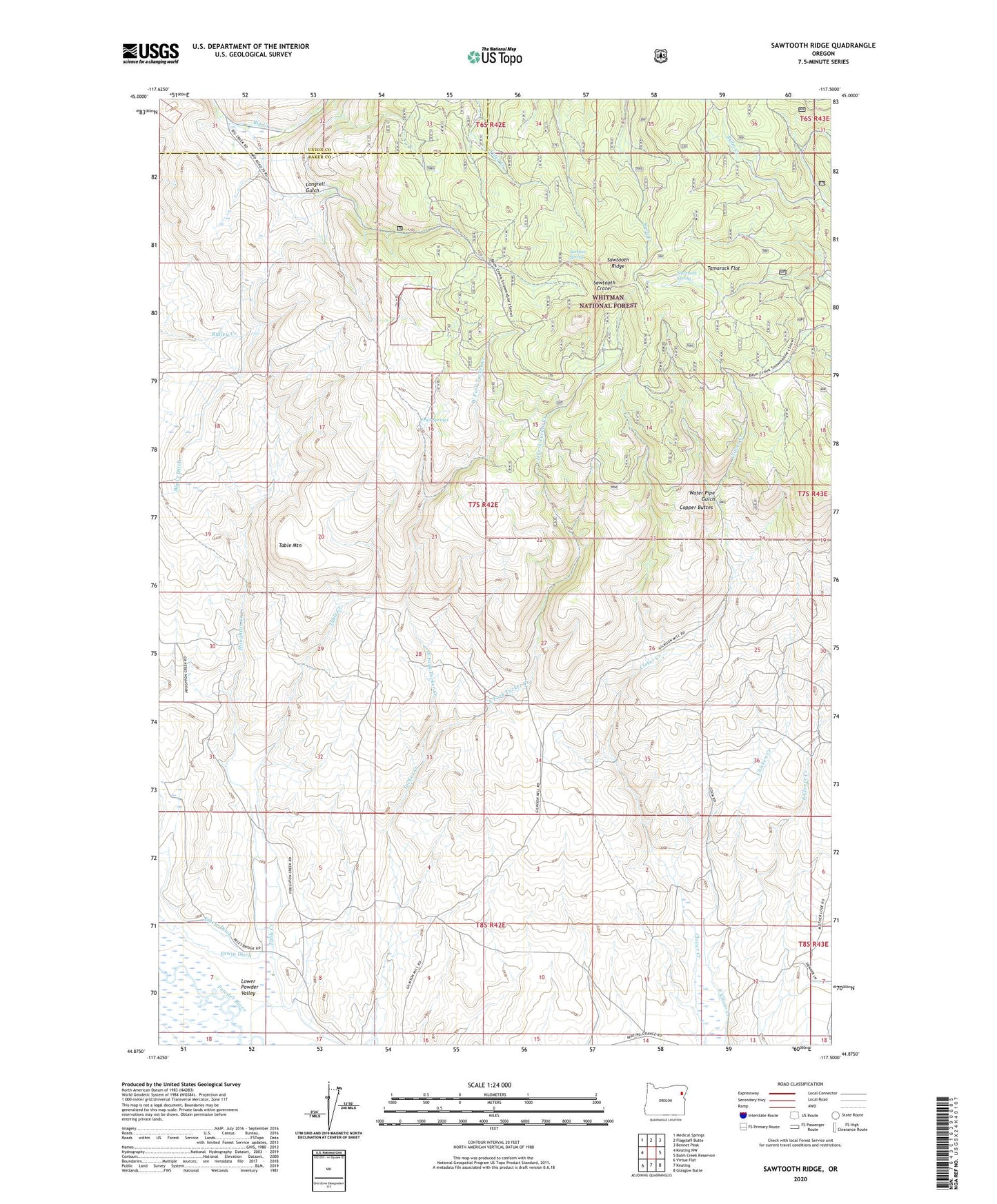
Sawtooth Ridge Oregon US Topo Map
Couldn't load pickup availability
Also explore the Sawtooth Ridge Forest Service Topo of this same quad for updated USFS data
2023 topographic map quadrangle Sawtooth Ridge in the state of Oregon. Scale: 1:24000. Based on the newly updated USGS 7.5' US Topo map series, this map is in the following counties: Baker, Union. The map contains contour data, water features, and other items you are used to seeing on USGS maps, but also has updated roads and other features. This is the next generation of topographic maps. Printed on high-quality waterproof paper with UV fade-resistant inks.
Quads adjacent to this one:
West: Keating NW
Northwest: Medical Springs
North: Flagstaff Butte
Northeast: Bennet Peak
East: Balm Creek Reservoir
Southeast: Glasgow Butte
South: Keating
Southwest: Virtue Flat
This map covers the same area as the classic USGS quad with code o44117h5.
Contains the following named places: Big Creek Ditch, Burkemont, Burkemont Post Office, Chicken Creek, Copper Buttes, East Fork Tucker Creek, Erwin, Erwin Post Office, Fruit Springs, Houghton Creek, Langrell Gulch, Sardine Spring, Sawtooth Crater, Sawtooth Ridge, Sawtooth Spring, Table Creek, Table Mountain, Tamarack Flat, Water Pipe Gulch, West Fork Tucker Creek