MyTopo
Kelsey Peak Oregon US Topo Map
Couldn't load pickup availability
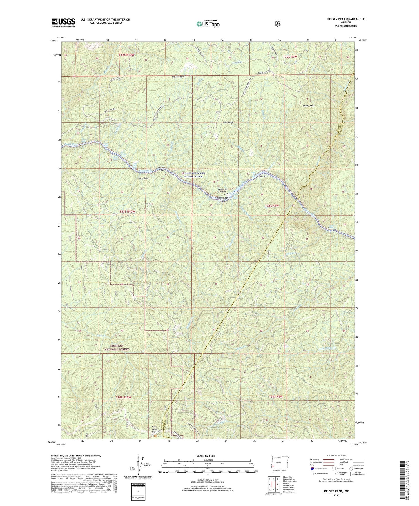
2020 topographic map quadrangle Kelsey Peak in the state of Oregon. Scale: 1:24000. Based on the newly updated USGS 7.5' US Topo map series, this map is in the following counties: Curry, Josephine. The map contains contour data, water features, and other items you are used to seeing on USGS maps, but also has updated roads and other features. This is the next generation of topographic maps. Printed on high-quality waterproof paper with UV fade-resistant inks.
Quads adjacent to this one:
West: Marial
Northwest: Eden Valley
North: Mount Bolivar
Northeast: Dutchman Butte
East: Bunker Creek
Southeast: Mount Peavine
South: Hobson Horn
Southwest: Brandy Peak
Contains the following named places: Bald Ridge, Battle Bar, Battle Bar Recreation Area, Battle Bar Riffle, Bear Camp Viewpoint Recreation Site, Big Boulder Rapids, Big Meadows, China Bar, Corral Creek, Ditch Creek, Ditch Creek Recreation Site, Dulog Creek, Dulog Creek Recreation Area, Dulog Riffle, East Fork Hewitt Creek, East Fork Kelsey Creek, Fort Lamerick, Hewitt Creek, Hewitt Creek Recreation Site, Island Rapids, Johns Riffle, Kelsey Creek, Kelsey Falls, Kelsey Peak, Kelsy Creek Campground, Long Gulch, Long Gulch Recreation Area, Long Gulch Riffle, Maggies Riffle, Missouri Bar, Missouri Creek, Paradise Creek, Quail Creek, Rogue Wild and Scenic River, Slide Creek, Trout Creek, Venner Creek, West Fork Mule Creek, Winkle Bar, Winkle Bar Airport, Winkle Bar Riffle