MyTopo
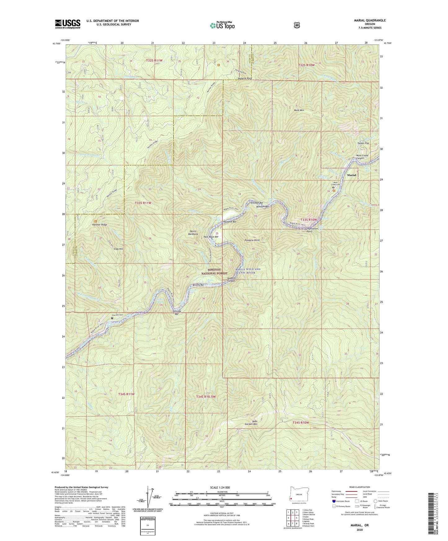
Marial Oregon US Topo Map
Couldn't load pickup availability
Also explore the Marial Forest Service Topo of this same quad for updated USFS data
2023 topographic map quadrangle Marial in the state of Oregon. Scale: 1:24000. Based on the newly updated USGS 7.5' US Topo map series, this map is in the following counties: Curry, Coos. The map contains contour data, water features, and other items you are used to seeing on USGS maps, but also has updated roads and other features. This is the next generation of topographic maps. Printed on high-quality waterproof paper with UV fade-resistant inks.
Quads adjacent to this one:
West: Illahe
Northwest: China Flat
North: Eden Valley
Northeast: Mount Bolivar
East: Kelsey Peak
Southeast: Hobson Horn
South: Brandy Peak
Southwest: Agness
This map covers the same area as the classic USGS quad with code o42123f8.
Contains the following named places: Blossom Bar, Blossom Bar Creek, Blossom Bar Rapids, Blossom Bar Recreation Site, Bobs Garden Mountain, Bobs Garden Trail, Brushy Bar, Brushy Bar Creek, Brushy Bar Recreation Site, Brushy Bar Riffle, Burns Creek, Camp Tacoma, China Bar Rapids, Clay Hill, Clay Hill Cemetery, Clay Hill Creek, Clay Hill Rapids, Clay Hill Stillwater, Coffeepot, Devils Backbone, Devils Stairs, Dostler Creek, East Creek, East Creek Recreation Site, East Mule Recreation Site, Fall Creek, Gleason Bar, Gleason Bar Recreation Site, Half Moon Bar, Half Moon Riffle, Hanging Rock, Huggins Canyon, Inspiration Point, Jackson Creek, Marial, Marial Lodge, Marial Post Office, Marks Creek, Mule Creek Canyon, Mule Creek Cemetery, Mule Mountain, Narrows, Panther Creek, Panther Ridge, Paradise Bar, Paradise Creek, Paradise Riffle, Pinnacle Point, Price Creek, Rocky Bar Creek, Rogue River Ranch, Shasta Costa Overlook, Slide Creek, Solitude Bar, Solitude Riffle, Stair Creek, Stair Creek Falls, Sulphur Spring, Tacoma Rapids, Tale Creek Recreation Site, Tate Creek, Tichenor Riffle, Tucker Flat, Tucker Flat Camp, West Fork Clay Hill Creek, West Mule Recreation Site, Wild Rogue Wilderness