MyTopo
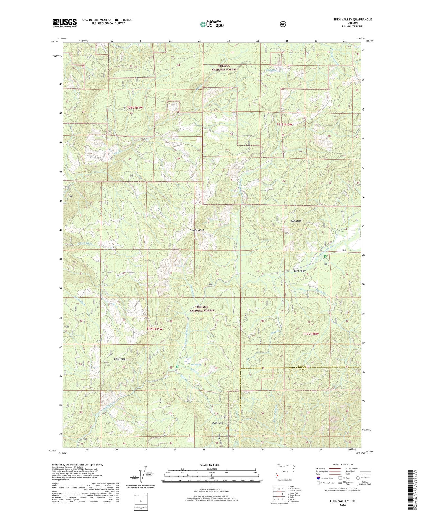
Eden Valley Oregon US Topo Map
Couldn't load pickup availability
Also explore the Eden Valley Forest Service Topo of this same quad for updated USFS data
2024 topographic map quadrangle Eden Valley in the state of Oregon. Scale: 1:24000. Based on the newly updated USGS 7.5' US Topo map series, this map is in the following counties: Coos, Curry. The map contains contour data, water features, and other items you are used to seeing on USGS maps, but also has updated roads and other features. This is the next generation of topographic maps. Printed on high-quality waterproof paper with UV fade-resistant inks.
Quads adjacent to this one:
West: China Flat
Northwest: Powers
North: Rasler Creek
Northeast: Bone Mountain
East: Mount Bolivar
Southeast: Kelsey Peak
South: Marial
Southwest: Illahe
This map covers the same area as the classic USGS quad with code o42123g8.
Contains the following named places: Ash Swamp, Barker Creek, Buck Creek, Buck Creek Campground, Buck Point, Camp Hope, Camp Number 2, Clear Creek, Clear Creek Camp, Coal Creek Camp, Doe Swamp, Eden Ridge, Eden Valley, Eden Valley Recreation Site, Elk Horn Creek, Foggy Creek, Foggy Creek Camp, Gobblers Knob, Lockhart Recreation Site, Old Red Mine, Pioneer Recreation Site, Table Rock, Wooden Rock Creek, Wooden Rock Guard Station